IMAGES TAKEN NEAR TO
Lanyon Road, TRURO, TR3 6HF
Introduction
This page details the photographs taken nearby to Lanyon Road, TR3 6HF by members of the Geograph project.
The Geograph project started in 2005 with the aim of publishing, organising and preserving representative images for every square kilometre of Great Britain, Ireland and the Isle of Man.

There are currently over 7.5m images from over14,400 individuals and you can help contribute to the project by visiting https://www.geograph.org.uk
Image Map
Images are licensed for reuse under creativecommons.org/licenses/by-sa/2.0
Notes
- Clicking on the map will re-center to the selected point.
- The higher the marker number, the further away the image location is from the centre of the postcode.
Image Listing (26 Images Found)
Images are licensed for reuse under creativecommons.org/licenses/by-sa/2.0
Image
Details
Distance
1
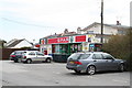
Post Office & Spar Shop at Playing Place
Playing Place is nowadays mainly a village of modern development, serving as a dormitory for Truro.
Image: © Rod Allday
Taken: 29 Mar 2009
0.05 miles
2
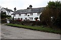
Alms Houses at Playing Place
The plaque on the wall reads Mr Lanyons Alms Houses 1726
Image: © Fred James
Taken: 13 Mar 2009
0.05 miles
3
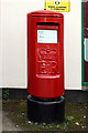
Elizabeth ii Pillar Box at Playing Place
Situated outside of the Post Office but don’t hang about when posting letters
Image: © Fred James
Taken: 5 Aug 2009
0.09 miles
4
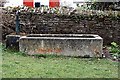
Drinking trough at Lanyon Road, Playing Place
This trough was originally near Image together with a smaller one for dogs.
The dog trough was taken as a souvenir by some American servicemen during the Second World War.
Image: © Fred James
Taken: 13 Mar 2009
0.09 miles
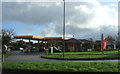
6
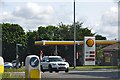
Cornwall : Shell Petrol Station
Looking towards a Shell station outside of Playing Place in Cornwall.
Image: © Lewis Clarke
Taken: 17 Jul 2015
0.11 miles
7
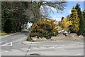
Playing Place
Looking down Old Coach Road at the junction with Holywell Road. Playing Place is a dormitory suburb of Truro composed mainly of 20th century detached houses and bungalows. The name "Playing Place" denotes a place where people used to meet for performances of Mystery Plays and the like.
Image: © Tony Atkin
Taken: 8 Apr 2006
0.12 miles
8
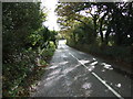
B3289, Playing Place
Heading south east towards Trelissick.
Image: © JThomas
Taken: 5 Nov 2014
0.12 miles