
IMAGES TAKEN NEAR TO
Baldhu, TRURO, TR3 6EG
Introduction
This page details the photographs taken nearby to TR3 6EG by members of the Geograph project.
The Geograph project started in 2005 with the aim of publishing, organising and preserving representative images for every square kilometre of Great Britain, Ireland and the Isle of Man.

There are currently over 7.5m images from over14,400 individuals and you can help contribute to the project by visiting https://www.geograph.org.uk
Image Map
Images are licensed for reuse under creativecommons.org/licenses/by-sa/2.0
Notes
- Clicking on the map will re-center to the selected point.
- The higher the marker number, the further away the image location is from the centre of the postcode.
Image Listing (8 Images Found)
Images are licensed for reuse under creativecommons.org/licenses/by-sa/2.0
Image
Details
Distance
1

Baldhu Church
The ecclesiastical parish of Baldhu was formed in 1847 from parts of Kea and Kenwyn parishes. The church is now closed but the church yard is still used for burials. Baldhu is Cornish for Black Mine.
Now converted into two dwellings. See Image
Image: © Fred James
Taken: 29 May 2006
0.02 miles
2

Old School Building Opposite Baldhu Church
Image: © Tony Atkin
Taken: 14 Jun 2008
0.02 miles
3

The former Baldhu parish church
Now converted into two dwellings.
Image: © Fred James
Taken: 21 Apr 2009
0.03 miles

5

Former Church of St Michael and All Angels
Now converted to housing.
Image: © Paul Barnett
Taken: 7 May 2014
0.05 miles
6

The disused church of St Michael and All Angels, Baldhu
Once the parish church of Baldhu, when this was a busy mining area. Now completely deserted - you can see the memorial to the 19C revivalist preacher Billy Bray, noted for 'his sanctified wit, Christian simplicity and fervid faith'
Image: © Sheila Russell
Taken: 22 Oct 2005
0.07 miles
7

Decaying Barn
An old decaying barn and a more recent corrugated iron shack in a field with ponies.
Image: © Tony Atkin
Taken: 14 Jun 2008
0.11 miles
8
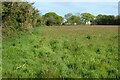
Pasture, Kea
The footpath at Kilters Farm passes this way.
Image: © Andrew Smith
Taken: 7 May 2022
0.18 miles