
IMAGES TAKEN NEAR TO
Threemilestone, TRURO, TR3 6DQ
Introduction
This page details the photographs taken nearby to TR3 6DQ by members of the Geograph project.
The Geograph project started in 2005 with the aim of publishing, organising and preserving representative images for every square kilometre of Great Britain, Ireland and the Isle of Man.

There are currently over 7.5m images from over14,400 individuals and you can help contribute to the project by visiting https://www.geograph.org.uk
Image Map
Images are licensed for reuse under creativecommons.org/licenses/by-sa/2.0
Notes
- Clicking on the map will re-center to the selected point.
- The higher the marker number, the further away the image location is from the centre of the postcode.
Image Listing (5 Images Found)
Images are licensed for reuse under creativecommons.org/licenses/by-sa/2.0
Image
Details
Distance
1
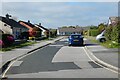
Victoria Road, Threemilestone, Kenwyn
Bungalows in suburbia to the west of Truro.
Image: © Andrew Smith
Taken: 5 May 2022
0.16 miles
3
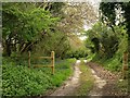
Track to Polstein Farm
Bluebells by the farm road, seen from an old lane winding along the rear of Polstain Road in Threemilestone.
Image: © Derek Harper
Taken: 1 May 2009
0.18 miles
4
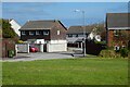
Hawthorn Way, Threemilestone, Kenwyn
Part of the urbanised area that has developed close to the A390 west of Truro.
Image: © Andrew Smith
Taken: 5 May 2022
0.19 miles
5
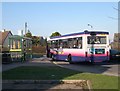
Bus Stop at Threemilestone
Threemilestone was built as a post-war residential suburb of Truro, adding to existing inter-war ribbon development housing. It was separated from Truro by farmland but is now almost contiguous with the city due to rapid commercial development along the A390. The bus stop is at the heart of Threemilestone with local shops nearby.
Image: © Tony Atkin
Taken: 10 Dec 2005
0.24 miles