
IMAGES TAKEN NEAR TO
Porthkea, TRURO, TR3 6AH
Introduction
This page details the photographs taken nearby to TR3 6AH by members of the Geograph project.
The Geograph project started in 2005 with the aim of publishing, organising and preserving representative images for every square kilometre of Great Britain, Ireland and the Isle of Man.

There are currently over 7.5m images from over14,400 individuals and you can help contribute to the project by visiting https://www.geograph.org.uk
Image Map
Images are licensed for reuse under creativecommons.org/licenses/by-sa/2.0
Notes
- Clicking on the map will re-center to the selected point.
- The higher the marker number, the further away the image location is from the centre of the postcode.
Image Listing (7 Images Found)
Images are licensed for reuse under creativecommons.org/licenses/by-sa/2.0
Image
Details
Distance
1
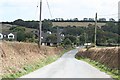
Porth Kea
Port Kea is a hamlet consisting mostly of 20th century housing with a few older cottages. Porth usually designates a port but this hamlet is on high ground and could never have been a port.
Image: © Tony Atkin
Taken: 28 Aug 2006
0.10 miles
2
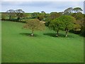
Farmland, Kea
Fields and woodland viewed from beside the former chapel at Porthkea.
Image: © Andrew Smith
Taken: 10 May 2019
0.13 miles
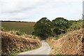
4
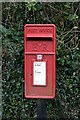
Elizabeth ii post box at Porth Kea
Detail
Image: © Fred James
Taken: 13 Mar 2009
0.16 miles
5
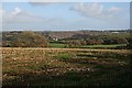
Near Porthkea
A recently harvested field with a glimpse of Malpas and Truro River in the centre
Image: © Fred James
Taken: 11 Nov 2008
0.17 miles
6
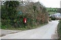
Elizabeth ii post box at Porth Kea
General view
Image: © Fred James
Taken: 13 Mar 2009
0.19 miles
7
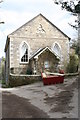
Porth Kea Methodist Church
Built in 1869 and Listed Grade II - more information here: http://www.imagesofengland.org.uk/Details/Default.aspx?id=63462&mode=adv. Now converted to residential use.
Image: © Rod Allday
Taken: 29 Mar 2009
0.23 miles