
IMAGES TAKEN NEAR TO
Holbrook Row, HAYLE, TR27 6HW
Introduction
This page details the photographs taken nearby to Holbrook Row, TR27 6HW by members of the Geograph project.
The Geograph project started in 2005 with the aim of publishing, organising and preserving representative images for every square kilometre of Great Britain, Ireland and the Isle of Man.

There are currently over 7.5m images from over14,400 individuals and you can help contribute to the project by visiting https://www.geograph.org.uk
Image Map
Images are licensed for reuse under creativecommons.org/licenses/by-sa/2.0
Notes
- Clicking on the map will re-center to the selected point.
- The higher the marker number, the further away the image location is from the centre of the postcode.
Image Listing (54 Images Found)
Images are licensed for reuse under creativecommons.org/licenses/by-sa/2.0
Image
Details
Distance
1
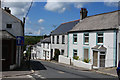
Chapel Hill, St Erth
Leading from the central crossroads down to the River Hayle. The chapel is now the Methodist Church.
Image: © Bill Boaden
Taken: 6 Jul 2014
0.01 miles
2

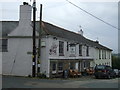
Chapel Hill, St Erth
Looking down Chapel Hill from outside the post office as it drops down to the bridge over the River Hayle.
Image: © Stephen McKay
Taken: 24 Mar 2009
0.02 miles
4
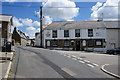
Star Inn, St Erth
A pub on the central crossroads of the village.
Image: © Bill Boaden
Taken: 6 Jul 2014
0.03 miles
5
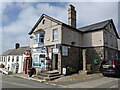
A change of name for the village store
It is now called the 'village store' not the 'convenience store' and is no longer run under the Mace banner. See: https://www.geograph.org.uk/photo/54694
Image: © David Medcalf
Taken: 14 Sep 2021
0.03 miles
6
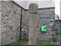
Old Wayside Cross
St Erth Churchtown Cross, a wayside cross - moved with an old head, shaft & base. Set in the churchyard in St Erth parish. Langdon WC No. 38. A Scheduled Monument https://historicengland.org.uk/listing/the-list/list-entry/1010845. See also http://www.geograph.org.uk/photo/1331234 and http://www.flickr.com/photos/ocifant/412918593.
Milestone Society National ID: CWPW_SER02
Image: © L Nott
Taken: 8 Apr 2019
0.03 miles
7
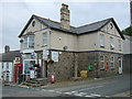
St Erth Post Office
Showing position of Postbox No. TR27 54.
See Image] for postbox.
Image: © JThomas
Taken: 13 Jul 2017
0.03 miles
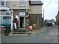
9
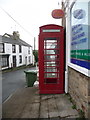
St. Erth: red telephone box
Looking along Chapel Hill, past the phone box which stands outside Image
Image: © Chris Downer
Taken: 17 Oct 2013
0.03 miles
10
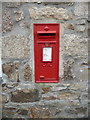
St. Erth: postbox № TR27 54
This George V-reign postbox is set into the side wall of Image
Image: © Chris Downer
Taken: 17 Oct 2013
0.03 miles