1
The Duke of Leeds public house, Leedstown, Cornwall
Image: © nick macneill
Taken: 4 Apr 2011
0.05 miles
2
Leedstown : B3280
Looking along the road at the junction.
Image: © Lewis Clarke
Taken: 29 Sep 2022
0.07 miles
3
The Duke of Leeds, Leedstown
Image: © Humphrey Bolton
Taken: 26 Feb 2012
0.08 miles
4
The Duke of Leeds
Doesn't look as if the Duke is enjoying this wet Tuesday any more than we are.
Image: © Stuart Logan
Taken: 9 Oct 2012
0.08 miles
5
The Duke of Leeds public house, Leedstown
Image: © JThomas
Taken: 11 Jul 2017
0.08 miles
6
The Duke of Leeds public house in Leedstown
The name of the pub and the village derives from the Duke of Leeds's ownership of the nearby Godolphin Estate, which passed from the Earl of Godolphin to him in 1766. The Duke's family name of Townsend is the name of a neighbouring village.
Image: © Rod Allday
Taken: 21 Oct 2011
0.08 miles
7
Direction Sign - Signpost by the B3280, Leedstown
Located in Leedstown, against the southeast corner wall of the Duke of Leeds pub on the west side of the crossroads of the B3302 Fraddam Road and the B3280 Praze Road. Crowan parish. 4 arms and double ball finial. All four arms, Hayle, Helston, Penzance and Redruth are now back in place. Grade II Listed details https://historicengland.org.uk/listing/the-list/list-entry/1142185. See also https://www.geograph.org.uk/photo/6043396 and https://www.geograph.org.uk/photo/6593461.
Milestone Society National ID: CW_SW6034
Image: © P Barnett
Taken: 2 Jul 2024
0.08 miles
8
Direction Sign ? Signpost
Located against the southeast corner wall of the Duke of Leeds pub on the west side of the crossroads of the B3202 Fraddam Road and the B3280 Praze Road in Leedstown in Crowan parish. 4 arms. 2 missing and double ball finial. Grade II Listed details https://historicengland.org.uk/listing/the-list/list-entry/1142185. The Redruth and Helston arms were lost before this photo was taken because it shows only the Penzance and Hayle arms in place. https://www.geograph.org.uk/photo/6043396 taken in 2011 shows only the Penzance arm remaining in place.
Milestone Society National ID: CW_SW6034
Image: © W Marsh
Taken: Unknown
0.08 miles
9
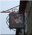
Sign for the Duke of Leeds public house, Leedstown
Image: © JThomas
Taken: 11 Jul 2017
0.08 miles
10
Old Direction Sign - Signpost by the B3280, Leedstown, Crowan Parish
Double ball finial, but now has only one arm; Toy foundry post, by the B3280/B3302 junction, in parish of Crowan (Kerrier District), Leedstown, beside wall corner of Duke of Leeds pub.
Surveyed
Milestone Society National ID: CW_SW6034
Image: © Milestone Society
Taken: Unknown
0.08 miles


