1
Crowan : Leedstown - Trenerth Road
Looking along Trenerth Road from Fraddam Road.
Image: © Lewis Clarke
Taken: 29 Sep 2022
0.06 miles
2
Central Garage, Leedstown
Image: © Humphrey Bolton
Taken: 26 Feb 2012
0.06 miles
3
The village hall
The focal point of Leedstown - the village hall. Who won bingo there? And how much did you win?
Image: © Ken Ballinger
Taken: 13 Sep 2005
0.07 miles
4
Green energy on a house in Leedstown
This house has both solar water heating panels and photovoltaic cells to gain free energy from the sun's rays. The high sunshine levels and clear air quality in Cornwall have given rise to many people installing PV cell arrays to take advantage of the Government's Feed In Tariff scheme whereby they will receive payment for producing electricity in this manner. However, the payments are due to be reduced drastically for any systems installed after 1 December 2011 so it remains to be seen whether the current installation rate will continue. It's unfortunate that the installations are such an eyesore and are not subject to planning approval except on listed buildings or in conservation areas.
Image: © Rod Allday
Taken: 21 Oct 2011
0.08 miles
5
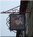
Sign for the Duke of Leeds public house, Leedstown
Image: © JThomas
Taken: 11 Jul 2017
0.08 miles
6
Old Direction Sign - Signpost by the B3280, Leedstown, Crowan Parish
Double ball finial, but now has only one arm; Toy foundry post, by the B3280/B3302 junction, in parish of Crowan (Kerrier District), Leedstown, beside wall corner of Duke of Leeds pub.
Surveyed
Milestone Society National ID: CW_SW6034
Image: © Milestone Society
Taken: Unknown
0.08 miles
7
Direction Sign ? Signpost
Located against the southeast corner wall of the Duke of Leeds pub on the west side of the crossroads of the B3202 Fraddam Road and the B3280 Praze Road in Leedstown in Crowan parish. 4 arms. 2 missing and double ball finial. Grade II Listed details https://historicengland.org.uk/listing/the-list/list-entry/1142185. The Redruth and Helston arms were lost before this photo was taken because it shows only the Penzance and Hayle arms in place. https://www.geograph.org.uk/photo/6043396 taken in 2011 shows only the Penzance arm remaining in place.
Milestone Society National ID: CW_SW6034
Image: © W Marsh
Taken: Unknown
0.09 miles
8
Direction Sign - Signpost by the B3280, Leedstown
Located in Leedstown, against the southeast corner wall of the Duke of Leeds pub on the west side of the crossroads of the B3302 Fraddam Road and the B3280 Praze Road. Crowan parish. 4 arms and double ball finial. All four arms, Hayle, Helston, Penzance and Redruth are now back in place. Grade II Listed details https://historicengland.org.uk/listing/the-list/list-entry/1142185. See also https://www.geograph.org.uk/photo/6043396 and https://www.geograph.org.uk/photo/6593461.
Milestone Society National ID: CW_SW6034
Image: © P Barnett
Taken: 2 Jul 2024
0.09 miles
9
The Duke of Leeds, Leedstown
Image: © Humphrey Bolton
Taken: 26 Feb 2012
0.09 miles
10
The Duke of Leeds
Doesn't look as if the Duke is enjoying this wet Tuesday any more than we are.
Image: © Stuart Logan
Taken: 9 Oct 2012
0.09 miles


