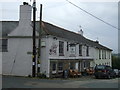
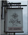
IMAGES TAKEN NEAR TO
Ercus Row, St. Erth Hill, HAYLE, TR27 6BY
Introduction
This page details the photographs taken nearby to Ercus Row, St. Erth Hill, TR27 6BY by members of the Geograph project.
The Geograph project started in 2005 with the aim of publishing, organising and preserving representative images for every square kilometre of Great Britain, Ireland and the Isle of Man.

There are currently over 7.5m images from over14,400 individuals and you can help contribute to the project by visiting https://www.geograph.org.uk
Image Map
Images are licensed for reuse under creativecommons.org/licenses/by-sa/2.0
Notes
- Clicking on the map will re-center to the selected point.
- The higher the marker number, the further away the image location is from the centre of the postcode.
Image Listing (30 Images Found)
Images are licensed for reuse under creativecommons.org/licenses/by-sa/2.0
Image
Details
Distance
1
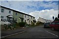
St Erth : Old Vicarage Road
Looking along the road off Fore Street.
Image: © Lewis Clarke
Taken: 28 Sep 2022
0.09 miles
2
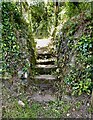
Stone Stile SW5534f
St Erth Hill. Well signposted path leading through fields to Trenedros in Porthcollum Lane.
Coffen stile with five steps.
Coffen stile – a stile built over a pit – like a granite cattle grid.
Coffen is a Cornish word for a man-made hole in the ground.
Public footpath 111/10/1 gold
Image: © Linda King
Taken: 17 Jun 2021
0.16 miles
3
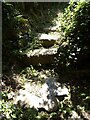
Stone Stile SW5534l
On a field path from Church Street to Tremellin Lane.
A small coffen-type stile in the corner of a field. One of several on this path.
Coffen stile – a stile built over a pit – like a granite cattle grid.
Coffen is a Cornish word for a man-made hole in the ground.
Public footpath 111/9/1 gold Tremellin Lane to Church Street
Image: © Linda King
Taken: 23 Jun 2021
0.17 miles
4

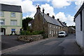
St Erth : Steppy Downs Road
Looking along a country lane.
Image: © Lewis Clarke
Taken: 28 Sep 2022
0.18 miles
6

Entrance to BK Fisheries
Coarse fishing opportunities in the Hayle valley.
Image: © Bill Boaden
Taken: 6 Jul 2014
0.20 miles
7
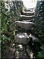
Stone Stile SW5534m
On a field path from Church Street to Tremellin Lane.
A large, rising, coffen-type stile with three steps
Coffen stile – a stile built over a pit – like a granite cattle grid.
Coffen is a Cornish word for a man-made hole in the ground.
Public footpath 111/9/1 gold Tremellin Lane to Church Street
Image: © Linda King
Taken: 23 Jun 2021
0.20 miles
8
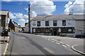
Star Inn, St Erth
A pub on the central crossroads of the village.
Image: © Bill Boaden
Taken: 6 Jul 2014
0.21 miles