IMAGES TAKEN NEAR TO
Binnerton Road, HAYLE, TR27 6BJ
Introduction
This page details the photographs taken nearby to Binnerton Road, TR27 6BJ by members of the Geograph project.
The Geograph project started in 2005 with the aim of publishing, organising and preserving representative images for every square kilometre of Great Britain, Ireland and the Isle of Man.

There are currently over 7.5m images from over14,400 individuals and you can help contribute to the project by visiting https://www.geograph.org.uk
Image Map
Images are licensed for reuse under creativecommons.org/licenses/by-sa/2.0
Notes
- Clicking on the map will re-center to the selected point.
- The higher the marker number, the further away the image location is from the centre of the postcode.
Image Listing (6 Images Found)
Images are licensed for reuse under creativecommons.org/licenses/by-sa/2.0
Image
Details
Distance
1
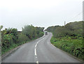
B3302 northwest of Sunny Corner
The location is not living up to its name today.
Image: © Stuart Logan
Taken: 9 Oct 2012
0.03 miles
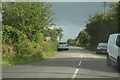
2
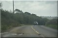
Crowan : Leedstown - B3302
Looking along the B3302.
Image: © Lewis Clarke
Taken: 29 Sep 2022
0.07 miles
3
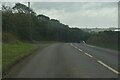
Crowan : Leedstown - B3302
Looking along the B3302.
Image: © Lewis Clarke
Taken: 29 Sep 2022
0.11 miles
5
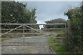
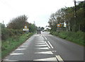
Crowan : Track
A track heads beyond the gate.
Image: © Lewis Clarke
Taken: 29 Sep 2022
0.15 miles
6
Crowan : Leedstown : Road
A road off Chapel Road.
Image: © Lewis Clarke
Taken: 29 Sep 2022
0.16 miles