
IMAGES TAKEN NEAR TO
The Dunes, HAYLE, TR27 5GD
Introduction
This page details the photographs taken nearby to The Dunes, TR27 5GD by members of the Geograph project.
The Geograph project started in 2005 with the aim of publishing, organising and preserving representative images for every square kilometre of Great Britain, Ireland and the Isle of Man.

There are currently over 7.5m images from over14,400 individuals and you can help contribute to the project by visiting https://www.geograph.org.uk
Image Map
Images are licensed for reuse under creativecommons.org/licenses/by-sa/2.0
Notes
- Clicking on the map will re-center to the selected point.
- The higher the marker number, the further away the image location is from the centre of the postcode.
Image Listing (18 Images Found)
Images are licensed for reuse under creativecommons.org/licenses/by-sa/2.0
Image
Details
Distance
1
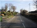
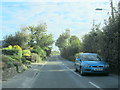
Loggans Road
On the outskirts of Hayle.
Image: © Burgess Von Thunen
Taken: 1 Mar 2012
0.04 miles
3
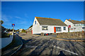
Gwinear-Gwithian : St Nicholas Close
Looking along St Nicholas Close off Loggans Road.
Image: © Lewis Clarke
Taken: 2 Dec 2019
0.06 miles
4

Chimney on Upton Towans
This chimney is on the former site of the National Explosives Factory, giving the Towans the local name of 'Dynamite Towans'. At the height of industrial activity during the First World War, nearly 1800 people were employed at the Explosives Factory, making it an important part of local and national history.
Image: © Rod Allday
Taken: 7 Nov 2008
0.08 miles
5
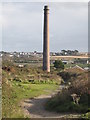
Chimney on Upton Towans
This is the former site of the National Explosives Factory, giving the Towans the local name of 'Dynamite Towans'. At the height of industrial activity during the First World War, nearly 1800 people were employed at the Explosives Factory, making it an important part of local and national history.
Image: © Rod Allday
Taken: 7 Nov 2008
0.08 miles
7
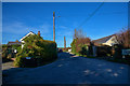
Gwinear-Gwithian : Road
A small road between houses off Loggans Road.
Image: © Lewis Clarke
Taken: 2 Dec 2019
0.08 miles
8
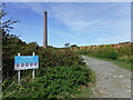
The entrance to the Upton Towans Nature Reserve
This is the site of the former National Explosives factory. Few actual buildings survive, but the ones that do are historically important. The building and chimney here were the Nitric Acid Works.
Image: © David Medcalf
Taken: 8 Sep 2019
0.09 miles
9
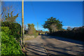
Gwinear-Gwithian : Loggans Road B3301
Looking along Loggans Road in the Gwinear-Gwithian Parish.
Image: © Lewis Clarke
Taken: 2 Dec 2019
0.10 miles
10
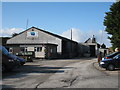
Western Blocks factory on Upton Towans
Producers of concrete blocks and ready-mixed concrete for the local construction industry.
Image: © Rod Allday
Taken: 7 Nov 2008
0.11 miles