
IMAGES TAKEN NEAR TO
Phillack Hill, HAYLE, TR27 5AD
Introduction
This page details the photographs taken nearby to Phillack Hill, TR27 5AD by members of the Geograph project.
The Geograph project started in 2005 with the aim of publishing, organising and preserving representative images for every square kilometre of Great Britain, Ireland and the Isle of Man.

There are currently over 7.5m images from over14,400 individuals and you can help contribute to the project by visiting https://www.geograph.org.uk
Image Map
Images are licensed for reuse under creativecommons.org/licenses/by-sa/2.0
Notes
- Clicking on the map will re-center to the selected point.
- The higher the marker number, the further away the image location is from the centre of the postcode.
Image Listing (52 Images Found)
Images are licensed for reuse under creativecommons.org/licenses/by-sa/2.0
Image
Details
Distance
2
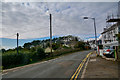
Phillack : Churchtown Road
Looking along Churchtown Road.
Image: © Lewis Clarke
Taken: 22 Oct 2019
0.04 miles
3
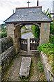
Phillack : St Felicitas and St Piala's Church - Lych Gate
Looking towards the gate providing an entry in and out of the church.
Image: © Lewis Clarke
Taken: 22 Oct 2019
0.05 miles
4
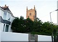
Phillack : Phillack Church
The church steeple of Phillack Church from Lethlean Lane.
Image: © Lewis Clarke
Taken: 3 Jul 2011
0.05 miles
5
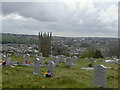
Phillack church taken from the cemetery
Town of Hayle.
Image: © Ivan Taylor
Taken: 9 Aug 2004
0.05 miles
8

Wayside Cross, Phillack
Close-up of reverse of Image - the obverse depicts a crucifixion.
With a few metres of its location prior to 1856 see https://www.heritagegateway.org.uk/Gateway/Results_Single.aspx?uid=MCO5662&resourceID=1020
Grade II Listed Nᴼ 1016154 see https://historicengland.org.uk/listing/the-list/list-entry/1016154
Milestone Society National ID: CWPW_HAY01
Image: © Paul Barnett
Taken: 19 Mar 2026
0.05 miles
9

Wayside Cross, Phillack
Detail of the obverse (of Image) depicting a crucifixion.
With a few metres of its location prior to 1856 see https://www.heritagegateway.org.uk/Gateway/Results_Single.aspx?uid=MCO5662&resourceID=1020
Grade II Listed Nᴼ 1016154 see https://historicengland.org.uk/listing/the-list/list-entry/1016154
Milestone Society National ID: CWPW_HAY01
Image: © Paul Barnett
Taken: 19 Mar 2026
0.05 miles
10
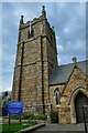
Phillack : St Felicitas and St Piala's Church
The church dates from the 12th century. The tower is 15th century. It was rebuilt between 1856 and 1857 by William White and re-consecrated on 12 May 1857.
Image: © Lewis Clarke
Taken: 22 Oct 2019
0.06 miles