
IMAGES TAKEN NEAR TO
Longstone, ST. IVES, TR26 3LT
Introduction
This page details the photographs taken nearby to Longstone, TR26 3LT by members of the Geograph project.
The Geograph project started in 2005 with the aim of publishing, organising and preserving representative images for every square kilometre of Great Britain, Ireland and the Isle of Man.

There are currently over 7.5m images from over14,400 individuals and you can help contribute to the project by visiting https://www.geograph.org.uk
Image Map
Images are licensed for reuse under creativecommons.org/licenses/by-sa/2.0
Notes
- Clicking on the map will re-center to the selected point.
- The higher the marker number, the further away the image location is from the centre of the postcode.
Image Listing (13 Images Found)
Images are licensed for reuse under creativecommons.org/licenses/by-sa/2.0
Image
Details
Distance
1
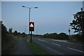
Penwith : St Ives Road
St Ives Road between Lelant and St Ives and up through Carbis Bay.
Image: © Lewis Clarke
Taken: 2 Jul 2011
0.02 miles
2
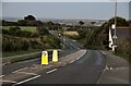
Penwith : St Ives Road
A road between St Ives and Lelant in Penwith.
Image: © Lewis Clarke
Taken: 2 Jul 2011
0.04 miles
3
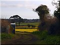
The glow of a host of daffodils, Longstone
A field of daffodils, with a portaloo at the gate for the flower pickers.
Image: © David Smith
Taken: 11 Mar 2016
0.05 miles
4
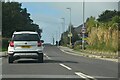
Carbis Bay : St Ives Road A3074
Looking along the road.
Image: © Lewis Clarke
Taken: 29 Sep 2022
0.07 miles
5
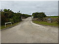
The entrance to Gonwin Manor
Now a hotel, but shown on the OS map as Gonwin Farm.
Image: © David Medcalf
Taken: 4 Sep 2015
0.09 miles
7
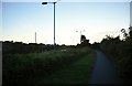
Penwith : St Ives Road Pavement
A pavement for pedestrians along St Ives Road.
Image: © Lewis Clarke
Taken: 2 Jul 2011
0.15 miles
8
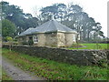
The north Lodgehouse at Trevethoe House
Built in the early 19th century as a lodge to the large Trevethoe estate. It was Grade II listed https://britishlistedbuildings.co.uk/101327816-north-lodge-at-trevethoe-house-st-ives#.YdYBFGjP3IU & https://historicengland.org.uk/listing/the-list/list-entry/1327816 in 1972.
Image: © Richard Law
Taken: 24 Dec 2021
0.17 miles
9
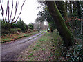
Lodge and lane to Trevethoe Barton
On the edge of Cubit Plantation the private lane leads down to the old manor of Trevethoe.
Image: © Sheila Russell
Taken: 18 Jan 2006
0.18 miles
10
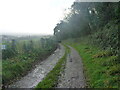
Private lane to Trevethoe House
There's no public right of way along this rather mucky lane, but it leads to Image and the nearby very fine Trevethoe House, which dates from the 19th century, and which is Grade II listed https://historicengland.org.uk/listing/the-list/list-entry/1143322
Image: © Richard Law
Taken: 24 Dec 2021
0.19 miles