IMAGES TAKEN NEAR TO
Laity Lane, ST. IVES, TR26 3HW
Introduction
This page details the photographs taken nearby to Laity Lane, TR26 3HW by members of the Geograph project.
The Geograph project started in 2005 with the aim of publishing, organising and preserving representative images for every square kilometre of Great Britain, Ireland and the Isle of Man.

There are currently over 7.5m images from over14,400 individuals and you can help contribute to the project by visiting https://www.geograph.org.uk
Image Map
Images are licensed for reuse under creativecommons.org/licenses/by-sa/2.0
Notes
- Clicking on the map will re-center to the selected point.
- The higher the marker number, the further away the image location is from the centre of the postcode.
Image Listing (13 Images Found)
Images are licensed for reuse under creativecommons.org/licenses/by-sa/2.0
Image
Details
Distance
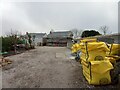
1
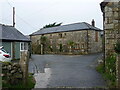
Barn conversion at Laity Farm
This impressive looking barn in the middle of the farmyard is Laity Granary.
Image: © Richard Law
Taken: 24 Dec 2021
0.06 miles
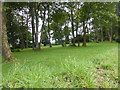
2
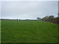
Field on the western side of Carbis Bay
Image: © Richard Law
Taken: 24 Dec 2021
0.09 miles
4
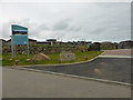
The entrance to Una
Una is a new holiday home development, not yet shown on the 1:50,000 OS maps.
Image: © David Medcalf
Taken: 4 Sep 2015
0.12 miles
5
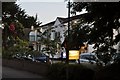
New houses above Carbis Bay
A development of 3 large houses, being built just off Laity Lane above Carbis Bay
Image: © Richard Law
Taken: 25 Dec 2021
0.17 miles
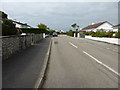
8
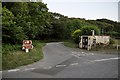
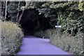
Penwith : Country Road
A country road just outside of Longstone which leads towards Trevarrack.
Image: © Lewis Clarke
Taken: 2 Jul 2011
0.21 miles
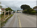
9
Longstone : Roturua Apartments
A B&B on Trencrom Lane near Carbis Bay and Longstone.
Image: © Lewis Clarke
Taken: 2 Jul 2011
0.22 miles
10
Longstone : Church Lane
Church Lane heads out of Longstone and back towards the main road and into Lelant.
Image: © Lewis Clarke
Taken: 2 Jul 2011
0.22 miles