
IMAGES TAKEN NEAR TO
Church Lane, ST. IVES, TR26 3DZ
Introduction
This page details the photographs taken nearby to Church Lane, TR26 3DZ by members of the Geograph project.
The Geograph project started in 2005 with the aim of publishing, organising and preserving representative images for every square kilometre of Great Britain, Ireland and the Isle of Man.

There are currently over 7.5m images from over14,400 individuals and you can help contribute to the project by visiting https://www.geograph.org.uk
Image Map
Images are licensed for reuse under creativecommons.org/licenses/by-sa/2.0
Notes
- Clicking on the map will re-center to the selected point.
- The higher the marker number, the further away the image location is from the centre of the postcode.
Image Listing (38 Images Found)
Images are licensed for reuse under creativecommons.org/licenses/by-sa/2.0
Image
Details
Distance
1

Children's playground in Lelant in the late seventies
This photograph was probably taken in 1977, judging by the age of my children in the picture. This playground was quite a conspicuous feature of Lelant at the time, but I can find no evidence of it on any maps today, nor on Google Earth.
Image: © John Rostron
Taken: Unknown
0.07 miles
3
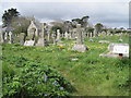
Ancient gravestones in Lelant cemetery
Image: © David Medcalf
Taken: 11 Sep 2018
0.11 miles
4

Lelant : West Cornwall Golf Club
The course was established in 1889 making it the oldest Golf club in Cornwall.
Image: © Lewis Clarke
Taken: 2 Jul 2011
0.12 miles
5
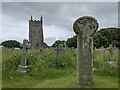
Old Wayside Cross in Lelant Cemetery, St Ives parish
Lelant Cemetery Cross No. 1, a wayside cross that has been moved with an old head and shaft. Set in the cemetery of St Uny's church, Lelant, in St Ives parish. Langdon WP No.40. Grade II Listed details https://historicengland.org.uk/listing/the-list/list-entry/1143354. See also https://www.flickr.com/photos/ocifant/2524290640.
Milestone Society National ID: CWPW_LEL06
Image: © L Nott
Taken: 14 Jul 2021
0.13 miles
6

Wayside Cross, Lelant Cemetery
A medieval wheel head cross in the cemetery amongst the graves, partly hidden by a gravestone of a soldier buried in 1942.
Grade II Listed Nᴼ 1136863 see https://historicengland.org.uk/listing/the-list/list-entry/1136863
Milestone Society National ID: CWPW_LEL05
Image: © Paul Barnett
Taken: 19 Mar 2026
0.14 miles
7

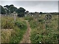
Lelant : Lelant Cemetery
This cemetery is close to St Uny's Church and there is a path between that and the headstones.
Image: © Lewis Clarke
Taken: 2 Jul 2011
0.14 miles
8

Lelant : Footpath
A footpath through West Cornwall Golf Club with a warning about danger-golf.
Image: © Lewis Clarke
Taken: 2 Jul 2011
0.15 miles
9
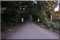
Lelant : Private Road
A private road heading down towards the beach and through the golf course.
Image: © Lewis Clarke
Taken: 2 Jul 2011
0.15 miles
10
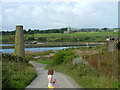
Church at Lelant from Riviere Towans
Image: © Peter Jemmett
Taken: 24 Aug 2008
0.15 miles