IMAGES TAKEN NEAR TO
Porthia Road, ST. IVES, TR26 2FW
Introduction
This page details the photographs taken nearby to Porthia Road, TR26 2FW by members of the Geograph project.
The Geograph project started in 2005 with the aim of publishing, organising and preserving representative images for every square kilometre of Great Britain, Ireland and the Isle of Man.

There are currently over 7.5m images from over14,400 individuals and you can help contribute to the project by visiting https://www.geograph.org.uk
Image Map
Images are licensed for reuse under creativecommons.org/licenses/by-sa/2.0
Notes
- Clicking on the map will re-center to the selected point.
- The higher the marker number, the further away the image location is from the centre of the postcode.
Image Listing (14 Images Found)
Images are licensed for reuse under creativecommons.org/licenses/by-sa/2.0
Image
Details
Distance
4
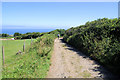
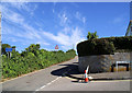
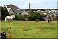
Track below Trenwith Lane
Public footpath down the hill towards the town and beach.
Image: © Pierre Terre
Taken: 22 Jul 2008
0.18 miles
5
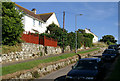
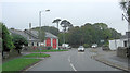
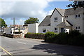
Trenwith Lane
Trenwith Lane at the junction with Gwel an Wheal.
Image: © Pierre Terre
Taken: 23 Jul 2008
0.19 miles
6
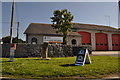
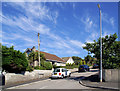
St Ives : Community Fire Station
St Ives Community Fire Station is an on-call fire station.
Image: © Lewis Clarke
Taken: 2 Jul 2011
0.20 miles
8
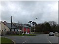
A3306, Higher Stennack passes The Community Fire Station
Image: © Stuart Logan
Taken: 9 Oct 2012
0.21 miles
10
The Leach Pottery
The Leach Pottery was established by Bernard Leach and Shoji Hamada in 1920. It has recently been restored both as a museum and a working pottery.
Image: © Tony Atkin
Taken: 6 Jun 2008
0.21 miles