
IMAGES TAKEN NEAR TO
Victoria Place, ST. IVES, TR26 1PY
Introduction
This page details the photographs taken nearby to Victoria Place, TR26 1PY by members of the Geograph project.
The Geograph project started in 2005 with the aim of publishing, organising and preserving representative images for every square kilometre of Great Britain, Ireland and the Isle of Man.

There are currently over 7.5m images from over14,400 individuals and you can help contribute to the project by visiting https://www.geograph.org.uk
Image Map
Images are licensed for reuse under creativecommons.org/licenses/by-sa/2.0
Notes
- Clicking on the map will re-center to the selected point.
- The higher the marker number, the further away the image location is from the centre of the postcode.
Image Listing (1076 Images Found)
Images are licensed for reuse under creativecommons.org/licenses/by-sa/2.0
Image
Details
Distance
1
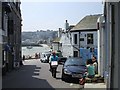
St Ives
One of the numerous narrow streets.
Image: © Kenneth Allen
Taken: 7 Jun 2007
0.01 miles
2
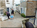
Bethesda Hill
This little hill leads down to the harbour via The Wharf.
Image: © Raymond Cubberley
Taken: 27 Jun 2012
0.01 miles
3
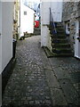
Cobbled street surface on Carnglaze Place
One of several parts of Carnglaze Place where the original 17th/18th century granite cobblestones are still in situ; the whole area was Grade II listed for this reason https://britishlistedbuildings.co.uk/101327771-the-street-surface-st-ives#.Yc-P7GjP3IU & https://historicengland.org.uk/listing/the-list/list-entry/1327771 in 1972.
Image: © Richard Law
Taken: 23 Dec 2021
0.01 miles
4
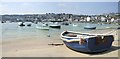
St Ives Harbour
A safe mooring location
Image: © Kenneth Allen
Taken: 7 Jun 2007
0.01 miles
5
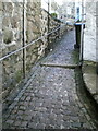
Cobbles and granite steps on Bethesda Hill
One of several similar narrow streets in the older part of St Ives, still surfaced in the 17th/18th century granite cobblestones and steps. This one was Grade II listed https://britishlistedbuildings.co.uk/101312641-the-street-surface-and-granite-steps-st-ives#.Yc9NbmjP3IU & https://historicengland.org.uk/listing/the-list/list-entry/1312641 in 1972.
Image: © Richard Law
Taken: 23 Dec 2021
0.02 miles
6
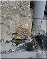
OS benchmark - St Ives, St Brigid's Apartments
An OS cutmark on the wall of a school (?) converted to apartments; originally levelled in 1953 at 5.481m above Ordnance Datum Newlyn.
Image: © Richard Law
Taken: 12 Oct 2015
0.02 miles
7
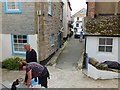
Bethesda Place
The streets are getting narrower!
Image: © Raymond Cubberley
Taken: 27 Jun 2012
0.02 miles
8
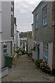
Bethesda Hill
A narrow pedestrianised street leading down to St Ives Harbour.
Image: © Ian Capper
Taken: 26 Oct 2011
0.02 miles
9
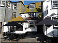
Part of the Sloop Inn, St Ives
A great spot to sit and watch St Ives harbourfront for a while.
Image: © Jeremy Bolwell
Taken: 6 Oct 2010
0.02 miles
10
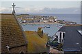
Over the rooftops
Looking across St Ives Harbour from Tregenna Terrace. On the left is part of the roof of St Ives Roman Catholic Church, dedicated to The Sacred Heart and St. Ia
Image: © Ian Capper
Taken: 26 Oct 2011
0.02 miles