IMAGES TAKEN NEAR TO
Ventnor Terrace, ST. IVES, TR26 1DX
Introduction
This page details the photographs taken nearby to Ventnor Terrace, TR26 1DX by members of the Geograph project.
The Geograph project started in 2005 with the aim of publishing, organising and preserving representative images for every square kilometre of Great Britain, Ireland and the Isle of Man.

There are currently over 7.5m images from over14,400 individuals and you can help contribute to the project by visiting https://www.geograph.org.uk
Image Map
Images are licensed for reuse under creativecommons.org/licenses/by-sa/2.0
Notes
- Clicking on the map will re-center to the selected point.
- The higher the marker number, the further away the image location is from the centre of the postcode.
Image Listing (367 Images Found)
Images are licensed for reuse under creativecommons.org/licenses/by-sa/2.0
Image
Details
Distance
1
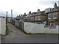
The service lane for houses in Channel View and Alexandra Road
Image: © David Smith
Taken: 12 Mar 2016
0.03 miles
2
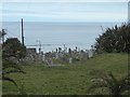
Barnoon Cemetery, St Ives
Overlooking Porthmeor Beach
Image: © David Smith
Taken: 12 Mar 2016
0.04 miles
4
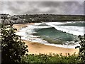
Porthmeor Beach
Porthmeor Beach St Ives
Image: © Richard Johns
Taken: 10 May 2002
0.05 miles
5
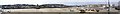
Panoramic view of St. Ives from harbour wall
This is a 180 degree panorama of St. Ives, Cornwall, as seen from Smeatons Pier.
Image: © andy
Taken: 28 Jul 2005
0.05 miles
6
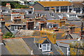
View over St. Ives
The foreground building is the Old Stennack School, now mainly used for community health purposes.
Image: © Robin Webster
Taken: 16 May 2013
0.06 miles
7
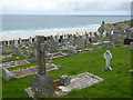
Barnoon Cemetery St Ives
Overlooking Porthmeor Beach.
Image: © Rod Allday
Taken: 18 Sep 2015
0.07 miles
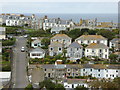
8
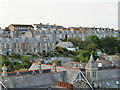
St Ives : Rooftops
Looking across the rooftops in St Ives from the top of the hill.
Image: © Lewis Clarke
Taken: 2 Jul 2011
0.07 miles
9
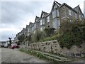
Terraced houses in Windsor Hill, St Ives
Image: © David Smith
Taken: 12 Mar 2016
0.07 miles
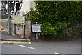
10
Houses off Bullans Lane St Ives
Bullans Lane is the steep hill on the left, leading from The Stennack up to Barnoon.
Image: © Rod Allday
Taken: 18 Sep 2015
0.08 miles