
IMAGES TAKEN NEAR TO
Portloe, TRURO, TR2 5QU
Introduction
This page details the photographs taken nearby to TR2 5QU by members of the Geograph project.
The Geograph project started in 2005 with the aim of publishing, organising and preserving representative images for every square kilometre of Great Britain, Ireland and the Isle of Man.

There are currently over 7.5m images from over14,400 individuals and you can help contribute to the project by visiting https://www.geograph.org.uk
Image Map
Images are licensed for reuse under creativecommons.org/licenses/by-sa/2.0
Notes
- Clicking on the map will re-center to the selected point.
- The higher the marker number, the further away the image location is from the centre of the postcode.
Image Listing (93 Images Found)
Images are licensed for reuse under creativecommons.org/licenses/by-sa/2.0
Image
Details
Distance
1

Portloe: road to Veryan
On the left is Spring Parc https://historicengland.org.uk/listing/the-list/list-entry/1219249?section=official-list-entry . Seen from where the coast path turns sharply back to the left, not along the road shown, which does, however, carry NCN3.
Image: © Derek Harper
Taken: 25 Jun 2025
0.00 miles
2
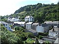
View away from the Harbour, Portloe
Taken from path on hillside.
Image: © Curtis Bateman
Taken: 31 Jul 2007
0.01 miles
3
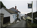
Ship Inn, Portloe
The Ship Inn in the village of Portloe.
Image: © Philip Halling
Taken: 30 Sep 2010
0.01 miles
4
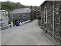
Junction of roads in Portloe
Looking south-westward from beside The United Church.
Image: © Peter Wood
Taken: 5 May 2017
0.02 miles
5
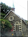
All Saints United Church of England and Methodist Church
Image: © Paul Barnett
Taken: 1 Jan 2016
0.03 miles
6

All Saints' Church, Portloe
"Formerly lifeboat house. Rebuilt and extended circa 1890" https://historicengland.org.uk/listing/the-list/list-entry/1219262?section=official-list-entry .
Image: © Derek Harper
Taken: 25 Jun 2025
0.03 miles
7

Houses, Portloe
The first three properties are listed together as "Blue House, 2 lime kilns and Cliff Garden" https://historicengland.org.uk/listing/the-list/list-entry/1328924?section=official-list-entry ; further along is an even bluer house.
Image: © Derek Harper
Taken: 25 Jun 2025
0.03 miles
8
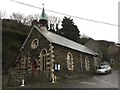
Portloe: All Saints' Church
Grade II listed.
Website: http://portloechurch.org.uk
Image: © Jonathan Hutchins
Taken: 3 Dec 2016
0.03 miles
9
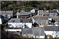
Looking down on Portloe Village
A view down onto the village from the coast path.
Image: © Tony Atkin
Taken: 14 Mar 2010
0.03 miles
10
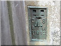
Ordnance Survey Cut Mark
This mark can be found on the roadside wall of Portloe Church. The benchmark height is recorded as being 15.606 metres above sea level.
For more detail see : http://www.bench-marks.org.uk/bm22416
Image: © Peter Wood
Taken: 5 May 2017
0.04 miles