1
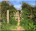
Hedge and bank near Trethennal Manor
Looking south from the lane near Treviskey towards the farm buildings at Trethennal Manor.
Image: © Simon Mortimer
Taken: 13 Apr 2019
0.15 miles
2
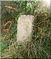
Stone Stile, Treviskey
250m West of the village on Cornwall footpath 327/32/2 looking from the field.
The view looking from the road is
Image
Image: © Jayne Tovey
Taken: 2 Aug 2023
0.18 miles
3
Stone Stile, Treviskey
250m West of the village on Cornwall footpath 327/32/2 looking from the road.
The view looking from the field is
Image
Image: © Jayne Tovey
Taken: 2 Aug 2023
0.18 miles
4
The lane towards Treviskey
Image: © Simon Mortimer
Taken: 13 Apr 2019
0.21 miles
5
Buildings known as 'Black Garages' on junction to Treviskey/ Portloe and Portholland
The countryside here is very pretty, but mainly just lanes, hills and fields. These sheds can be seen at a very familiar junction on the road to Veryan, so I thought they would make a change from all the lanes, hills and fields.
Former wayside garage and petrol station, sadly in decay. Well known local landmark.
Image: © Kieran Evans
Taken: 30 Dec 2006
0.22 miles
6
The renovated Black Garages near Treviskey
Recently repaired and repainted, the former wayside garage and petrol station's previous state can be seen in
Image
Image: © Simon Mortimer
Taken: 13 Apr 2019
0.23 miles
7
Old Direction Sign - Signpost north of Trethennal Manor
Ball finial - three arms; Holman by the UC road, in parish of Veryan (Carrick District), Trethennal Manor, partly in the bank on the Southwest side of the crossroads North of Trethennal Manor. Opposite guide stone: CW_XVER2
Image
Surveyed
Milestone Society National ID: CW_SW9340B
Image: © I Thompson
Taken: 17 Sep 2010
0.24 miles
8
Old Guide Stone north of Trethennal, Veryan Parish
By the A4078, in parish of Veryan (Carrick District), North of Trethennal, at Treviskey turn, beside derelict petrol pump.
Surveyed
Milestone Society National ID: CW_XVER2
Image: © Milestone Society
Taken: Unknown
0.24 miles
9
Old Guide Stone west of Treviskey
Carved stone by the unclassified crossroads, in parish of Veryan (Carrick District), Trethennal, Treviskey turn, beside large garages.
Inscription reads:-
: Gorran : : SᵗAustle / Tregony / Truro : : Veryan :
Cornwall & Scilly HER.
HER Number: 177647 https://www.heritagegateway.org.uk/Gateway/Results_Single.aspx?uid=MCO53433&resourceID=1020
Surveyed
Milestone Society National ID: CW_XVER2.
Image: © Rosy Hanns
Taken: 24 May 2019
0.24 miles
10
Old Guide Stone west of Treviskey
Carved stone by the unclassified crossroads, in parish of Veryan (Carrick District), Trethennal, Treviskey turn, beside large garages.
Inscription reads:-
: Gorran : : SᵗAustle / Tregony / Truro : : Veryan :
Cornwall & Scilly HER.
HER Number: 177647 https://www.heritagegateway.org.uk/Gateway/Results_Single.aspx?uid=MCO53433&resourceID=1020
Surveyed
Milestone Society National ID: CW_XVER2
Image: © P Barnett
Taken: 30 Jun 2024
0.24 miles


