
IMAGES TAKEN NEAR TO
Victory Hill, TRURO, TR2 5DQ
Introduction
This page details the photographs taken nearby to Victory Hill, TR2 5DQ by members of the Geograph project.
The Geograph project started in 2005 with the aim of publishing, organising and preserving representative images for every square kilometre of Great Britain, Ireland and the Isle of Man.

There are currently over 7.5m images from over14,400 individuals and you can help contribute to the project by visiting https://www.geograph.org.uk
Image Map
Images are licensed for reuse under creativecommons.org/licenses/by-sa/2.0
Notes
- Clicking on the map will re-center to the selected point.
- The higher the marker number, the further away the image location is from the centre of the postcode.
Image Listing (129 Images Found)
Images are licensed for reuse under creativecommons.org/licenses/by-sa/2.0
Image
Details
Distance
2
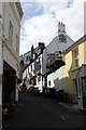
The Victory Inn, Victory Hill, St Mawes
18th century Grade II Listed inn, possibly originally a house. The inn claims to be the oldest pub in St Mawes and to possibly date back to the 16th century. Directory entries include; 1830, 1844 & 1852 not listed but beerhouses are not listed either; 1856 Edward Dotson; 1873-1883 Mrs Sarah Dotson; 1889-1906 John Arthur Dotson (& cab proprietor); 1914 James E Libby.
Image: © Jo and Steve Turner
Taken: 2 Jul 2019
0.01 miles
3
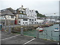
Part of the harbour, St. Mawes, Cornwall
There is always something going on to watch here.
Image: © Jeremy Bolwell
Taken: 29 Sep 2013
0.02 miles
5

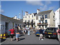
Bohella Road
A narrow back road behind properties along the Quay.
Image: © Hugh Craddock
Taken: 10 Jul 2025
0.02 miles
6
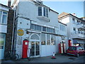
Old filling station in St. Mawes
Non-operational I assume but nice to see.
Image: © Jeremy Bolwell
Taken: 18 May 2013
0.02 miles
7
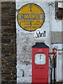
Signs at the former garage in St Mawes
Relics of the past.
Image: © Rod Allday
Taken: 17 Aug 2014
0.02 miles

9
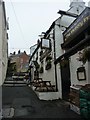
The Victory Inn, St Mawes
Tucked away on Victory Hill just off of the harbour you can find the Victory Inn.
Image: © Steve Barnes
Taken: 5 Sep 2010
0.02 miles
10
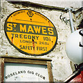
Old AA Sign on Kings Road, St Mawes
Old AA Sign set on the wall of Pomeroys Garage, the Roseland Gig Club on the northwest side of the A3078 Kings Road, St Mawes, 3 miles east of Falmouth. St Just in Roseland parish.
This is the Circular, village name on black band, no Motor Union symbol or name type, dating from 1923, showing distances Tregony 10½ London 263¼. The sign was removed from the wall at some time between October 2018 and October 2022.
There were five series of AA signs, mostly dating from 1923 and made by Francis & Co / Franco in Deptford, London. The village name and distance to London or Dublin were normally displayed.
See also https://www.geograph.org.uk/photo/3467287 and https://www.flickr.com/photos/keith-v/50787900342.
Milestone Society National ID: CW-STMAW
Image: © Milestone Society
Taken: Unknown
0.03 miles