1
On the A390
A390 approaching Grampound.
Image: © Robert Ashby
Taken: 19 Aug 2014
0.02 miles
2
Old Milestone by the A390 in Grampound
Carved stone post by the A390, in parish of GRAMPOUND WITH CREED (RESTORMEL District), by public weighbridge, just West of tollhouse, on grass verge, on North side of road. Truro stone, erected by the Truro turnpike trust in the 18th century.
Inscription reads:-
FROM
TRURO
8
MILES
Grade II listed.
List Entry Number: 1396215
Milestone Society National ID: CW_TOSA08
Image: © Paul Barnett
Taken: 23 Jan 2023
0.03 miles
3
Old Milestone by the A390 in Grampound
Carved stone post by the A390, in parish of GRAMPOUND WITH CREED (RESTORMEL District), by public weighbridge, just West of tollhouse, on grass verge, on North side of road. Truro stone, erected by the Truro turnpike trust in the 18th century.
Inscription reads:-
FROM
TRURO
8
MILES
Grade II listed.
List Entry Number: 1396215 https://historicengland.org.uk/listing/the-list/list-entry/1396215
Milestone Society National ID: CW_TOSA08.
Image: © Rosy Hanns
Taken: 17 Apr 2019
0.03 miles
4
Old Milestone by the A390 in Grampound
Carved stone post by the A390, in parish of GRAMPOUND WITH CREED (RESTORMEL District), by public weighbridge, just West of tollhouse, on grass verge, on North side of road. Truro stone, erected by the Truro turnpike trust in the 18th century.
Inscription reads:-
FROM
TRURO
8
MILES
Grade II Listed. List Entry Number:1396215
https://historicengland.org.uk/listing/the-list/list-entry/1396215
Milestone Society National ID: CW_TOSA08.
Image: © Ian Thompson
Taken: 1 Jun 1996
0.03 miles
5
Entering Grampound on A390
Image: © John Firth
Taken: 12 Jun 2014
0.04 miles
6
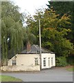
Toll house on edge of Grampound
Image: © David Smith
Taken: 17 Oct 2018
0.04 miles
7
A390
Image: © Paul Barnett
Taken: 3 Feb 2023
0.06 miles
8
Grampound Tollhouse by the A390, Fore Street, Grampound
Tollhouse by the A390, in parish of Grampound with Creed (Restormel District), Toll House, Fore Street, Grampound, TR2 4RX.
Cornwall & Scilly HER.
HER Number: 22980 https://www.heritagegateway.org.uk/Gateway/Results_Single.aspx?uid=MCO26128&resourceID=1020
Surveyed
Milestone Society National ID: CW.GRA02
Image: © Alan Rosevear
Taken: 26 Feb 2009
0.06 miles
9
A390, Grampound
Image: © Alex McGregor
Taken: 16 Apr 2013
0.06 miles
10
Public footpath alongside the Fal River
Public footpath (a real 'leafy lane') going south from Grampound immediately alongside the Fal River. On the opposite bank through the trees can just be seen a football pitch (home of Grampound FC - one of the oldest in Cornwall having been founded in 1902 and still playing at the start of the 2020 season).
Image: © Mike Lyne
Taken: 16 Apr 2020
0.10 miles


