IMAGES TAKEN NEAR TO
Grampound, TRURO, TR2 4RD
Introduction
This page details the photographs taken nearby to TR2 4RD by members of the Geograph project.
The Geograph project started in 2005 with the aim of publishing, organising and preserving representative images for every square kilometre of Great Britain, Ireland and the Isle of Man.

There are currently over 7.5m images from over14,400 individuals and you can help contribute to the project by visiting https://www.geograph.org.uk
Image Map
Images are licensed for reuse under creativecommons.org/licenses/by-sa/2.0
Notes
- Clicking on the map will re-center to the selected point.
- The higher the marker number, the further away the image location is from the centre of the postcode.
Image Listing (4 Images Found)
Images are licensed for reuse under creativecommons.org/licenses/by-sa/2.0
Image
Details
Distance
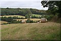
2
Driveway entrance on the left (and a Public Footpath) to Garlenick Manor Farm
Farm Entrance to Garlenick Manor Farm and a Public Footpath past it to the Village of Coombe from the unclassified road between Grampound and Hewas Water.
Image: © Mike Lyne
Taken: 19 May 2020
0.08 miles
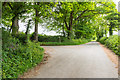
3
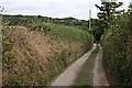
Lane to Nantellan
This narrow country lane snakes its way diagonally across the valley. It is the only road in this grid square.
Image: © Tony Atkin
Taken: 26 Aug 2006
0.19 miles
4
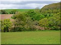
Farmland, Grampound
The western end of Garlennick Wood viewed from the road between Trevillick and Nantellan.
Image: © Andrew Smith
Taken: 9 May 2019
0.21 miles