IMAGES TAKEN NEAR TO
Fore Street, TRURO, TR2 4LQ

Introduction

This page details the photographs taken nearby to Fore Street, TR2 4LQ by members of the Geograph project.

The Geograph project started in 2005 with the aim of publishing, organising and preserving representative images for every square kilometre of Great Britain, Ireland and the Isle of Man.

There are currently over 7.5m images from over14,400 individuals and you can help contribute to the project by visiting https://www.geograph.org.uk

Image Map


Images are licensed for reuse under creativecommons.org/licenses/by-sa/2.0
Notes
  • Clicking on the map will re-center to the selected point.
  • The higher the marker number, the further away the image location is from the centre of the postcode.

Image Listing (39 Images Found)

Images are licensed for reuse under creativecommons.org/licenses/by-sa/2.0
  • ...
Image
Details
Distance
1
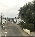
Fore Street, Probus
A variety of styles and ages of houses line the main road through Probus which was once part of the main road between Truro and St Austell until the opening of the bypass in 1996.
Image: © Tony Atkin Taken: 1 Jul 2006
0.02 miles
2
Former A390, Fore Street, Probus
Image: © Paul Barnett Taken: 8 Feb 2023
0.05 miles
3
Stone Stile SW8947c
On a tarmac footpath in the Gwell an Nans housing estate. A vertical stone slab above granite steps. Public footpath 316/5/4 (gold) from Probus to Trelowthas.
Image: © John Stringer Taken: 23 Apr 2021
0.07 miles
4
Stone Stile SW8947b
On a hedged footpath behind a triangle of land behind the war memorial for the Great War at the entrance road to the village hall, near ‘Kirkstall’. A granite beam above granite steps. Public footpath 316/5/4 (gold) from Probus to Trelowthas. Miss Cherry Taylor, now in her 80s, says these stiles were once at every field boundary. Only the first three still remain as the footpath merges into Gwell an Nans housing estate. She recalls, as a young girl, picnic parties used to be held on these stiles going down the valley.
Image: © John Stringer Taken: 23 Apr 2021
0.10 miles
5
Fore Street, Probus, Cornwall
Image: © nick macneill Taken: 5 Apr 2011
0.11 miles
6
Stone Stile SW8947a
On a hedged footpath behind a triangle of land behind the war memorial for the Great War at the entrance road to the village hall, beside ‘Kirkstall’. Vertical stone slab set into vertical stone pillars above a single stone step. Public footpath 316/5/4 (gold) from Probus to Trelowthas.
Image: © John Stringer Taken: 23 Apr 2021
0.11 miles
7
The Old Methodist Church, Probus
This church is now being used for a second-hand business and is painted a glorious golden yellow. Certainly an impressive sight in the late afternoon sun.
Image: © Tony Atkin Taken: 1 Jul 2006
0.14 miles
8
Postbox
Image: © Paul Barnett Taken: 20 Jan 2023
0.14 miles
9
Fore Street
Image: © Paul Barnett Taken: 8 Feb 2023
0.15 miles
10
Probus Village Centre from the Churchyard
Outside the church gate there are village residents milling around home produce and second hand stalls run by other villagers. Behind me, in the church, there is a coffee morning. This is one of the friendliest villages I have visited. There is a real sense of community here.
Image: © Tony Atkin Taken: 1 Jul 2006
0.16 miles
  • ...