
IMAGES TAKEN NEAR TO
Millpool, PENZANCE, TR20 9JF
Introduction
This page details the photographs taken nearby to Millpool, TR20 9JF by members of the Geograph project.
The Geograph project started in 2005 with the aim of publishing, organising and preserving representative images for every square kilometre of Great Britain, Ireland and the Isle of Man.

There are currently over 7.5m images from over14,400 individuals and you can help contribute to the project by visiting https://www.geograph.org.uk
Image Map
Images are licensed for reuse under creativecommons.org/licenses/by-sa/2.0
Notes
- Clicking on the map will re-center to the selected point.
- The higher the marker number, the further away the image location is from the centre of the postcode.
Image Listing (11 Images Found)
Images are licensed for reuse under creativecommons.org/licenses/by-sa/2.0
Image
Details
Distance
1
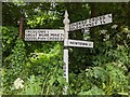
Direction Sign ? Signpost
Located on the southeast side of the road in Millpool in Breage parish. 3 arms and pyramid spear finial.
Milestone Society National ID: CW_SW5730
Image: © L Nott
Taken: 8 Jun 2020
0.03 miles
2
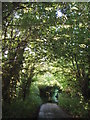
Lane at Millpool
Leading north towards Bostrase, late evening light.
Image: © Sheila Russell
Taken: 13 Jun 2006
0.04 miles
5
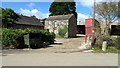
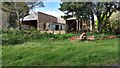
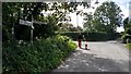
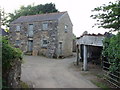
Barn at Millpool - 11 years on
There have been some changes since this photo was taken: http://www.geograph.org.uk/photo/185740
Image: © David Medcalf
Taken: 11 Sep 2017
0.07 miles
7
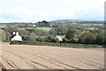
Field at Chyrase Farm Millpool
Newly seeded and rolled.
Image: © Rod Allday
Taken: 21 Oct 2011
0.14 miles
8
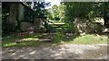
Polwhellan at Bostrase
There are a number of houses on the farm site, it seems.
Image: © David Medcalf
Taken: 11 Sep 2017
0.18 miles
9
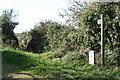
Footpath leading from Millpool to Greenberry Downs
It's not clear what the engraved stone relates to, which looks quite new.
Image: © Rod Allday
Taken: 21 Oct 2011
0.21 miles
10
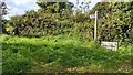
Footpath near Millpool
The engraved stone noted by others has now gone and a different stone has appeared which probably relates to the Parish boundary. St Hilary is the church near Goldsithney, SW5531.
For the previous stone, see: http://www.geograph.org.uk/photo/2687783
Image: © David Medcalf
Taken: 11 Sep 2017
0.22 miles