
IMAGES TAKEN NEAR TO
Tremethick Cross, PENZANCE, TR20 8UE
Introduction
This page details the photographs taken nearby to TR20 8UE by members of the Geograph project.
The Geograph project started in 2005 with the aim of publishing, organising and preserving representative images for every square kilometre of Great Britain, Ireland and the Isle of Man.

There are currently over 7.5m images from over14,400 individuals and you can help contribute to the project by visiting https://www.geograph.org.uk
Image Map
Images are licensed for reuse under creativecommons.org/licenses/by-sa/2.0
Notes
- Clicking on the map will re-center to the selected point.
- The higher the marker number, the further away the image location is from the centre of the postcode.
Image Listing (11 Images Found)
Images are licensed for reuse under creativecommons.org/licenses/by-sa/2.0
Image
Details
Distance
1
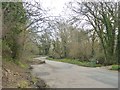
Lesingey Lane; bridge over Larriggan River
Image: © David Smith
Taken: 14 Mar 2016
0.06 miles
2
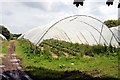
Growing Under Cover
Soft fruit, strawberries, are being grown here under polythene tunnels.
Image: © Tony Atkin
Taken: 19 Jul 2007
0.10 miles
3
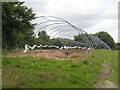
Polytunnel frames on the Bolitho Estate
The estate has many fields under polyculture but this one is lying fallow at present.
Image: © Rod Allday
Taken: 25 Jul 2009
0.10 miles
4
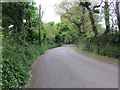
Boscathnoe Lane near Polteggan House
Looking south-westward.
Image: © Peter Wood
Taken: 1 May 2017
0.11 miles
5
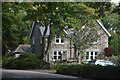
Penzance : Trevelyan
Looking towards a property on Boscathnoe Lane.
Image: © Lewis Clarke
Taken: 28 Sep 2022
0.13 miles
6
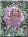
Old Wayside Cross south of Parc an Growes Farm, Madron Parish
Parc-an-Growes Cross, old head & shaft, Langdon WP No.65 by the wayside, in parish of Madron (Penwith District), Parc an Growes Farm.
to be surveyed
Milestone Society National ID: CWPW_MAD07
Image: © Milestone Society
Taken: Unknown
0.14 miles
7
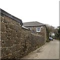
Stone wall alongside the road at Polteggan Farm
Image: © David Smith
Taken: 14 Mar 2016
0.16 miles
8
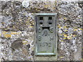
Ordnance Survey Flush Bracket 1572
This bracket can be found on the wall of a roadside building at Polteggan Farm. The benchmark height is recorded at being 67.581 metres above sea level.
For more detail see : http://www.bench-marks.org.uk/bm1680
Image: © Peter Wood
Taken: 1 May 2017
0.18 miles
9

Lesingey Lane
This is a narrow road through intensively cultivated countryside just outside Penzance.
Image: © Tony Atkin
Taken: 19 Jul 2007
0.19 miles
10
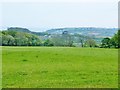
View from Trengwainton Gardens to the sea at Mount's Bay, Penzance
Image: © Derek Voller
Taken: 11 May 2016
0.23 miles