
IMAGES TAKEN NEAR TO
Trythall Moor, PENZANCE, TR20 8TA
Introduction
This page details the photographs taken nearby to Trythall Moor, TR20 8TA by members of the Geograph project.
The Geograph project started in 2005 with the aim of publishing, organising and preserving representative images for every square kilometre of Great Britain, Ireland and the Isle of Man.

There are currently over 7.5m images from over14,400 individuals and you can help contribute to the project by visiting https://www.geograph.org.uk
Image Map
Images are licensed for reuse under creativecommons.org/licenses/by-sa/2.0
Notes
- Clicking on the map will re-center to the selected point.
- The higher the marker number, the further away the image location is from the centre of the postcode.
Image Listing (5 Images Found)
Images are licensed for reuse under creativecommons.org/licenses/by-sa/2.0
Image
Details
Distance
2
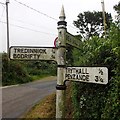
Direction Sign ? Signpost
Located on the southeast side of the T junction at Lower Ninnes in Madron parish. 3 arms and pyramid spear finial. Grade II Listed https://historicengland.org.uk/listing/the-list/list-entry/1143571. See also https://www.flickr.com/photos/38116967@N04/8108944162.
Milestone Society National ID: CW_SW4534A
Image: © J Blemings
Taken: 2 Oct 2019
0.02 miles
3
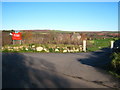
Entrance to Truthall CP School
The school buildings, dating from the C19th, are beside the road in Lower Ninnes but this new entrance provides better access.
Image: © Rod Allday
Taken: 12 Dec 2009
0.05 miles
4
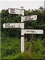
Direction Sign – Signpost near Trythall Farm, Lower Ninnes
Located on the south side of the crossroads on Gear Lane near Trythall Farm, Lower Ninnes in Madron parish. 4 replacement arms, which had been broken off, and a lost cone finial replaced by a ball finial. See also https://www.flickr.com/photos/38116967@N04/8108937307.
Milestone Society National ID: CW_SW4533A
Image: © J Blemings
Taken: 2 Oct 2019
0.18 miles
5
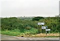
Junction of lanes south of Carfury
Image: © Christopher Hilton
Taken: 10 Oct 2001
0.18 miles