
IMAGES TAKEN NEAR TO
Newbridge, PENZANCE, TR20 8PX
Introduction
This page details the photographs taken nearby to TR20 8PX by members of the Geograph project.
The Geograph project started in 2005 with the aim of publishing, organising and preserving representative images for every square kilometre of Great Britain, Ireland and the Isle of Man.

There are currently over 7.5m images from over14,400 individuals and you can help contribute to the project by visiting https://www.geograph.org.uk
Image Map
Images are licensed for reuse under creativecommons.org/licenses/by-sa/2.0
Notes
- Clicking on the map will re-center to the selected point.
- The higher the marker number, the further away the image location is from the centre of the postcode.
Image Listing (9 Images Found)
Images are licensed for reuse under creativecommons.org/licenses/by-sa/2.0
Image
Details
Distance
1
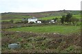
Boslow Farm
Boslow Farm with Carnyorth Common in the background.
Image: © Philip Halling
Taken: 6 Nov 2017
0.06 miles
2
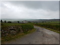
Access Road to Boslow Farmhouse
Rural setting not close to any settlement.
Image: © James Emmans
Taken: 28 May 2016
0.06 miles
3
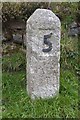
Milestone on the B3318
Milestone marked with '5' on the B3318 near Pendeen. Presumably that is 5 miles to Penzance.
Image: © Philip Halling
Taken: 6 Nov 2017
0.09 miles
4
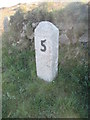
Milestone - Penzance 5
On the NE side of the road.
Image: © Adrian Dust
Taken: 21 Apr 2015
0.09 miles
5
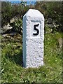
Old Milestone by the B3318, south of Boslow Farm
Carved stone post by the B3318, in parish of SANCREED (PENWITH District), Boslow Farm, below Beacon Hill, by wall, on East side of road. Erected by the Local Highways Board in the 19th century.
Inscription reads:-
5
Grade II Listed. List Entry Number: 1143857
https://historicengland.org.uk/listing/the-list/list-entry/1143857
Milestone Society National ID: CW_PZSJn05.
Image: © Ian Thompson
Taken: 10 Dec 2017
0.09 miles
6
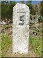
Old Milestone by the B3318, south of Boslow Farm
Carved stone post by the B3318, in parish of SANCREED (PENWITH District), Boslow Farm, below Beacon Hill, by wall, on East side of road. Erected by the Local Highways Board in the 19th century.
Inscription reads:-
5
Grade II listed.
List Entry Number: 1143857 https://historicengland.org.uk/listing/the-list/list-entry/1143857
Milestone Society National ID: CW_PZSJn05.
Image: © Rosy Hanns
Taken: 5 Jul 2019
0.09 miles
8
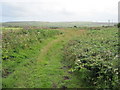
Farm track at Boslow
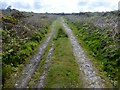
Taken in approx. the same place as http://www.geograph.org.uk/photo/1489816 but two months earlier, showing a significant difference in vegetation.
Image: © David Medcalf
Taken: 13 Jul 2009
0.23 miles
9
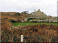
Cottages and old field hedges, near Carn Kenidjack
On the edge of the common land which surrounds Carn Kenidjack. Old hedges and old field boundaries.
Image: © Sheila Russell
Taken: 8 Dec 2005
0.24 miles