IMAGES TAKEN NEAR TO
Cripplesease, PENZANCE, TR20 8NF
Introduction
This page details the photographs taken nearby to Cripplesease, TR20 8NF by members of the Geograph project.
The Geograph project started in 2005 with the aim of publishing, organising and preserving representative images for every square kilometre of Great Britain, Ireland and the Isle of Man.

There are currently over 7.5m images from over14,400 individuals and you can help contribute to the project by visiting https://www.geograph.org.uk
Image Map
Images are licensed for reuse under creativecommons.org/licenses/by-sa/2.0
Notes
- Clicking on the map will re-center to the selected point.
- The higher the marker number, the further away the image location is from the centre of the postcode.
Image Listing (37 Images Found)
Images are licensed for reuse under creativecommons.org/licenses/by-sa/2.0
Image
Details
Distance
2
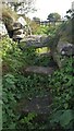
Stone Stile SW4936
A granite stile on a footpath that runs up the side of The Engine Inn, Cripplesease, from the B3311 road.
Three large granite slabs, one on the ground on each side of a raised central slab – a cattle stile.
Public footpath 119/37/4 silver from Cripplesease to Cold Harbour.
The footpath runs through the site of South Providence mine, suggesting it gave the miners access to the Engine Inn. There is a separate bridleway giving the main access to the mine further along B3311.
Image: © Carrie Langford
Taken: 9 Oct 2021
0.02 miles
4
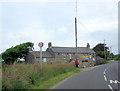
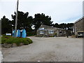
Field boundary near the Engine Inn
The Inn is visible, over its car park.
Image: © David Medcalf
Taken: 7 Sep 2013
0.03 miles
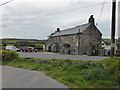
6
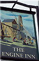
The Engine Inn
Pub sign at Cripplesease.
Image: © Maigheach-gheal
Taken: 15 Mar 2005
0.06 miles
7
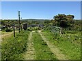
A Standing Stone by the farm track
The stone isn't marked on the OS map.
Image: © David Medcalf
Taken: 13 Jun 2021
0.09 miles
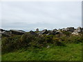
9
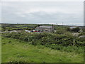
Fields on Trink Hill
Looking north east.
Image: © David Medcalf
Taken: 7 Sep 2013
0.14 miles
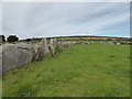
10
Drystone wall on Trink Hill
Looking towards Cripplesease engine house.
Image: © David Medcalf
Taken: 7 Sep 2013
0.16 miles