IMAGES TAKEN NEAR TO
Numphra, PENZANCE, TR19 7RP
Introduction
This page details the photographs taken nearby to Numphra, TR19 7RP by members of the Geograph project.
The Geograph project started in 2005 with the aim of publishing, organising and preserving representative images for every square kilometre of Great Britain, Ireland and the Isle of Man.

There are currently over 7.5m images from over14,400 individuals and you can help contribute to the project by visiting https://www.geograph.org.uk
Image Map
Images are licensed for reuse under creativecommons.org/licenses/by-sa/2.0
Notes
- Clicking on the map will re-center to the selected point.
- The higher the marker number, the further away the image location is from the centre of the postcode.
Image Listing (9 Images Found)
Images are licensed for reuse under creativecommons.org/licenses/by-sa/2.0
Image
Details
Distance
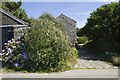
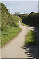
1
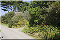
Access to Lower Numphra Farm
Access lane to Lower Numphra Farm
Image: © Elizabeth Scott
Taken: 31 Aug 2013
0.07 miles
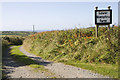
3
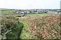
Fields between Numphra and Joppa
Dwellings at Lower and Higher Numphra (left and right) with Bartinney Downs in the distance on the right and the Leswidden radio mast just north of Cock's Roost Farm on the left. Our walk took down from Bartine Castle on top of the hill took us past the white house on the hillside (Higher Bartinney), but I got a bit lost and it took an unnecessarily long time to get to the point where this photo was taken. It was a case of being able to see the bigger picture, with good visibility of the landmarks all around, but not being able to quite work out where we were.
Image: © Jim Champion
Taken: 18 Aug 2005
0.10 miles
4
Higher Numphra Cottage
Higher Numphra Cottage from the road.
Image: © Elizabeth Scott
Taken: 31 Aug 2013
0.10 miles
5
Higher Numphra
Dwelling at Higher Numphra.
Image: © Elizabeth Scott
Taken: 31 Aug 2013
0.11 miles
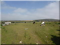
6
Footpath on Numphra Common
Looking towards the hamlet of Dowran.
Image: © Rod Allday
Taken: 29 Aug 2009
0.19 miles
7
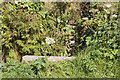
Water culvert
This culvert takes the stream under the road.
Image: © Elizabeth Scott
Taken: 31 Aug 2013
0.23 miles
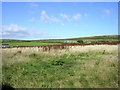
8
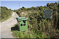
Access track to Bartinney
Access track to the properties at Bartinney.
Image: © Elizabeth Scott
Taken: 31 Aug 2013
0.23 miles
9
Lane to Carn Grean
Private lane to Carn Grean.
Image: © Elizabeth Scott
Taken: 31 Aug 2013
0.24 miles