IMAGES TAKEN NEAR TO
Cresswell Terrace, PENZANCE, TR19 7QF

Introduction

This page details the photographs taken nearby to Cresswell Terrace, TR19 7QF by members of the Geograph project.

The Geograph project started in 2005 with the aim of publishing, organising and preserving representative images for every square kilometre of Great Britain, Ireland and the Isle of Man.

There are currently over 7.5m images from over14,400 individuals and you can help contribute to the project by visiting https://www.geograph.org.uk

Image Map


Images are licensed for reuse under creativecommons.org/licenses/by-sa/2.0
Notes
  • Clicking on the map will re-center to the selected point.
  • The higher the marker number, the further away the image location is from the centre of the postcode.

Image Listing (16 Images Found)

Images are licensed for reuse under creativecommons.org/licenses/by-sa/2.0
Image
Details
Distance
1
Air shafts in a field near Botallock
Image: © habiloid Taken: 27 Jul 2013
0.12 miles
2
Cornwall : The B3306
From a road heading off the B3306.
Image: © Lewis Clarke Taken: 21 Apr 2018
0.17 miles
3
The B3306
House near Botallack.
Image: © Robert Ashby Taken: 20 Aug 2014
0.18 miles
4
The B3306 south of Trewellard
Image: © Philip Halling Taken: 6 Nov 2017
0.18 miles
5
The junction of No Go By Hill with the B3306
Image: © David Medcalf Taken: 3 Sep 2014
0.18 miles
6
The B3306 near Carnyorth
Image: © David Medcalf Taken: 3 Sep 2014
0.19 miles
7
The Queens Arms at Botallack
Image: © Row17 Taken: 29 Jul 2008
0.19 miles
8
The Queen's Arms, Botallock
Image: © Rob Purvis Taken: 2 Feb 2022
0.20 miles
9
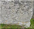
Ordnance Survey Cut Mark
This OS cut mark can be found on No7 Falmouth Place. It marks a point 129.140m above mean sea level.
Image: © Adrian Dust Taken: 4 Jun 2024
0.20 miles
10
Pub and Houses in Botallack Village
Botallack village is set on quiet back lanes as the main road passes the village to the south east.
Image: © Tony Atkin Taken: 4 Jul 2007
0.20 miles