
IMAGES TAKEN NEAR TO
Church Square, PENZANCE, TR19 7EZ
Introduction
This page details the photographs taken nearby to Church Square, TR19 7EZ by members of the Geograph project.
The Geograph project started in 2005 with the aim of publishing, organising and preserving representative images for every square kilometre of Great Britain, Ireland and the Isle of Man.

There are currently over 7.5m images from over14,400 individuals and you can help contribute to the project by visiting https://www.geograph.org.uk
Image Map
Images are licensed for reuse under creativecommons.org/licenses/by-sa/2.0
Notes
- Clicking on the map will re-center to the selected point.
- The higher the marker number, the further away the image location is from the centre of the postcode.
Image Listing (158 Images Found)
Images are licensed for reuse under creativecommons.org/licenses/by-sa/2.0
Image
Details
Distance
1
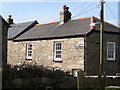
Church Square - St Just in Penwith
Church Square is very hidden and tucked away behind the Kings Arms and beside the churchyard. The cottages are some of the oldest in the town.
Image: © Sarah Smith
Taken: 13 Apr 2010
0.01 miles
2
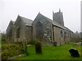
St. Just in Penwith Parish Church
The church of St Just is medieval. There are no remains of the early medieval church and only part of the chancel remains from the church built in 1334 which was dedicated on 13 July 1336 by the Bishop of Exeter, John Grandisson. The current building dates from the 15th century. The church is large and built of regular granite blocks. Both the body of the church and the tower are of the 15th century and the tower is of three stages. The aisles are built to the same design with alternating windows of two different patterns. The arcades have limestone piers. The font is modern but has been described as 14th century in date.
Image: © Rude Health
Taken: 8 May 2015
0.01 miles
3
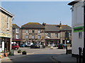
The Wellington Hotel - St Just in Penwith
The Wellington Hotel is situated in Market Square. Named after the Iron Duke after he had supposedly stayed there, the building was built before the Battle of Waterloo and became a hotel in 1813.
The photograph was taken near the gridline at the end of Market Street.
Image: © Sarah Smith
Taken: 13 Apr 2010
0.01 miles
4
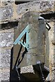
Sundial above the porch of St Just church
Telephoto shot to show the sundial above the porch of St. Just church. The sundial is badly weathered; it's almost impossible to see the numerals.
Image: © Elizabeth Scott
Taken: 13 Apr 2023
0.01 miles
5
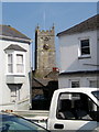
St Just church tower from the Lands End Road
A different view of the church from the main road looking in between the gleaming white houses and over the roofs of Church Square.
Image: © Sarah Smith
Taken: 13 Apr 2010
0.01 miles

7
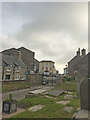
St Just from the churchyard of St Just church
Image: © thejackrustles
Taken: 21 Jun 2021
0.01 miles
8
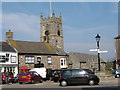
Kings Arms and parish church - St Just in Penwith
Across Market Square the pub and the church are in close proximity, both built in the 15th century.
The signpost shows directions for St Ives and Penzance with the A3071 Lands End Road running through the square.
Image: © Sarah Smith
Taken: 13 Apr 2010
0.01 miles
9
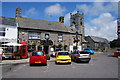
Kings Arms
One of several St Austell pubs in the town, this one facing the market square. The parish church is behind.
Image: © Bill Boaden
Taken: 11 Jul 2014
0.01 miles
10
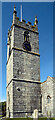
Church Tower, St. Just in Penwith Parish Church
Image: © habiloid
Taken: 30 May 2016
0.02 miles