IMAGES TAKEN NEAR TO
Penberth Valley, PENZANCE, TR19 6HH
Introduction
This page details the photographs taken nearby to Penberth Valley, TR19 6HH by members of the Geograph project.
The Geograph project started in 2005 with the aim of publishing, organising and preserving representative images for every square kilometre of Great Britain, Ireland and the Isle of Man.

There are currently over 7.5m images from over14,400 individuals and you can help contribute to the project by visiting https://www.geograph.org.uk
Image Map
Images are licensed for reuse under creativecommons.org/licenses/by-sa/2.0
Notes
- Clicking on the map will re-center to the selected point.
- The higher the marker number, the further away the image location is from the centre of the postcode.
Image Listing (25 Images Found)
Images are licensed for reuse under creativecommons.org/licenses/by-sa/2.0
Image
Details
Distance
1
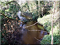
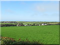
Penberth River nearly at the sea
The Penberth River (more of a stream) flows from Image in a south easterly direction to reach the sea at Penberth in Image Although only just over 3 miles long it is significant because the Penberth Valley forms such a deep crosscut into the West Penwith landscape.
Image: © Sheila Russell
Taken: 11 Jan 2006
0.03 miles
2
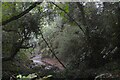
Treen : Penberth River
Looking towards the Penberth River in the valley.
Image: © Lewis Clarke
Taken: 30 Sep 2022
0.03 miles
4
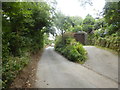
The lane to Penberth
The roadworks, just visible, are for broadband fibre.
Image: © David Medcalf
Taken: 3 Sep 2014
0.09 miles
6
Treen crossroads
This is the Southern Treen looking out across the Penberth valley from the B&B window.
Image: © Ralph Morgan
Taken: 17 May 2006
0.13 miles
7
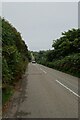
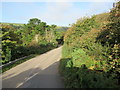
Road descending towards Treen
Looking down the B3315 between Sparnon and Treen.
Image: © DS Pugh
Taken: 1 Sep 2024
0.14 miles
9
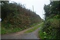
Treen : Track
A track off St Buryan Hill to Boscean.
Image: © Lewis Clarke
Taken: 30 Sep 2022
0.16 miles
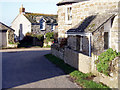
10
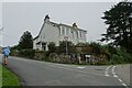
Tretheene and road junction
On the right is the B3315 with the road into Treen on the left.
Image: © DS Pugh
Taken: 1 Sep 2024
0.16 miles