
IMAGES TAKEN NEAR TO
St. Buryan, PENZANCE, TR19 6DG
Introduction
This page details the photographs taken nearby to TR19 6DG by members of the Geograph project.
The Geograph project started in 2005 with the aim of publishing, organising and preserving representative images for every square kilometre of Great Britain, Ireland and the Isle of Man.

There are currently over 7.5m images from over14,400 individuals and you can help contribute to the project by visiting https://www.geograph.org.uk
Image Map
Images are licensed for reuse under creativecommons.org/licenses/by-sa/2.0
Notes
- Clicking on the map will re-center to the selected point.
- The higher the marker number, the further away the image location is from the centre of the postcode.
Image Listing (9 Images Found)
Images are licensed for reuse under creativecommons.org/licenses/by-sa/2.0
Image
Details
Distance
1
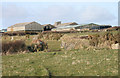
Downs Barn Farm
Downs Barn Farm taken from the footpath that comes diagonally across the field.
Image: © Elizabeth Scott
Taken: 28 Feb 2010
0.05 miles
3
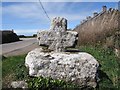
Old Wayside Cross
Chyoone Cross, a wayside cross with an old head. Set beside a minor road from the B3315 to the churchtown. St Buryan parish. Langdon WP No.07. Grade II* Listed https://historicengland.org.uk/listing/the-list/list-entry/1143932. See also http://www.flickr.com/photos/ocifant/412955752 and http://www.flickr.com/photos/38116967@N04/4035553808.
Milestone Society National ID: CWPW_SBU03
Image: © L Nott
Taken: 14 Jun 2019
0.18 miles
4
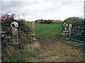
Gate and cross, Downs Barn farm
One of many ancient crosses in the fields and hedges near St Buryan.
Image: © Sheila Russell
Taken: 9 Feb 2006
0.20 miles
5
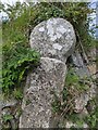
Old Wayside Cross
Boskenna Cross No. 2, a wayside cross with an old head & shaft. Set by a footpath up the lane northwest of Boskenna Gate Cross and the B3315 towards Boskennal in St Buryan parish. Grade II Listed https://historicengland.org.uk/listing/the-list/list-entry/1143931. See also http://www.flickr.com/photos/38116967@N04/4035583068, http://www.flickr.com/photos/ocifant/412955201 and http://www.geograph.org.uk/photo/119234.
Milestone Society National ID: CWPW_SBU02
Image: © L Nott
Taken: 25 Jun 2020
0.20 miles
6
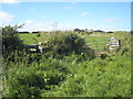
Hedge near Downs Barn Farm
Between the stile on the left and the gate on the right there is an ancient stone cross, buried in the vegetation. This is much more visible in the winter, as in Shiela Russell's February photo Image
Image: © Rod Allday
Taken: 23 May 2009
0.20 miles
7
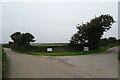
Entrance to Downs Barn Farm
The farm entrance on the B3315.
Image: © DS Pugh
Taken: 1 Sep 2024
0.22 miles
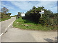
9
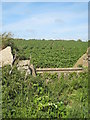
Cattle trough in the hedge near Downs Barn Farm
A crop of potatoes in the next field.
Image: © Rod Allday
Taken: 23 May 2009
0.24 miles