IMAGES TAKEN NEAR TO
Carne Road, PENZANCE, TR18 5QA

Introduction

This page details the photographs taken nearby to Carne Road, TR18 5QA by members of the Geograph project.

The Geograph project started in 2005 with the aim of publishing, organising and preserving representative images for every square kilometre of Great Britain, Ireland and the Isle of Man.

There are currently over 7.5m images from over14,400 individuals and you can help contribute to the project by visiting https://www.geograph.org.uk

Image Map


Images are licensed for reuse under creativecommons.org/licenses/by-sa/2.0
Notes
  • Clicking on the map will re-center to the selected point.
  • The higher the marker number, the further away the image location is from the centre of the postcode.

Image Listing (181 Images Found)

Images are licensed for reuse under creativecommons.org/licenses/by-sa/2.0
  • ...
Image
Details
Distance
1
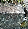
Ordnance Survey Rivet
This OS rivet can be found on the wall of No49 New Road. It marks a point 7.760m above mean sea level.
Image: © Adrian Dust Taken: 5 Jun 2024
0.05 miles
2
Street in Tolcarne
Image: © thejackrustles Taken: 21 Jun 2021
0.05 miles
3
Pilchards - "Cornish Sardines"
Salt pilchards packed in crates and transported all the way to Italy (the boxes are prestamped in Italian) where they are a delicacy. The Pilchard works, Newlyn. This industry has just closed as reported in the Independent October 29th.
Image: © Richard Greenwood Taken: 31 May 2004
0.06 miles
4
Apostolic church
Image: © Paul Barnett Taken: Unknown
0.06 miles
5
Passmore Edwards Art Gallery
Image: © N Chadwick Taken: 7 May 2016
0.07 miles
6
View towards Newlyn Tidal Observatory from Tolcarne FBM
Image: © thejackrustles Taken: 21 Jun 2021
0.07 miles
7
New Road towards Newlyn
Looking south west.
Image: © JThomas Taken: 13 Jul 2017
0.07 miles
8
Don't drop it
An interesting exercise in precision workmanship. Fitting large and expensive panes of glass into the windows of an art gallery.
Image: © Anthony Vosper Taken: 10 Apr 2019
0.07 miles
9
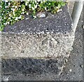
Ordnance Survey Fundamental Bench Mark - Tolcarne
This FBM can be found beside a road in Tolcarne. The benchmark height is recorded as being 28.5 metres above sea level. For more detail see : http://www.bench-marks.org.uk/bm1163
Image: © Peter Wood Taken: 1 May 2017
0.07 miles
10
Ordnance Survey Rivet
This OS rivet can be found on the wall of No15 New Road. It marks a point 5.715m above mean sea level.
Image: © Adrian Dust Taken: 5 Jun 2024
0.07 miles
  • ...