IMAGES TAKEN NEAR TO
Boase Street, PENZANCE, TR18 5EF
Introduction
This page details the photographs taken nearby to Boase Street, TR18 5EF by members of the Geograph project.
The Geograph project started in 2005 with the aim of publishing, organising and preserving representative images for every square kilometre of Great Britain, Ireland and the Isle of Man.

There are currently over 7.5m images from over14,400 individuals and you can help contribute to the project by visiting https://www.geograph.org.uk
Image Map
Images are licensed for reuse under creativecommons.org/licenses/by-sa/2.0
Notes
- Clicking on the map will re-center to the selected point.
- The higher the marker number, the further away the image location is from the centre of the postcode.
Image Listing (206 Images Found)
Images are licensed for reuse under creativecommons.org/licenses/by-sa/2.0
Image
Details
Distance
1
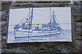
Decorative tiles at Trewarveneth Street
Several of these decorative tiles depicting trawlers can be seen around Newlyn. (Newlyn was a centre of the arts and crafts movement at the end of the nineteenth century to beginning of the twentieth.) These tiles on a building at the bottom of Trewarveneth Street depict the trawler Trewarveneth PZ196 which sadly no longer exists.
Image: © Elizabeth Scott
Taken: 24 Sep 2012
0.02 miles
2
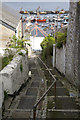
Stairway to harbour
Steep pedestrian stairway.
Image: © Elizabeth Scott
Taken: 24 Sep 2012
0.03 miles
3
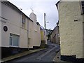
Church Street, Newlyn
A very narrow street leading up from the coastal road, Fore Street.
Image: © Bob Embleton
Taken: 10 Aug 2008
0.03 miles
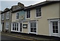
4
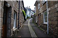
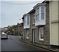
Boase Street, Newlyn
A narrow back street running away from the harbour.
Image: © Bill Boaden
Taken: 9 Jul 2014
0.03 miles
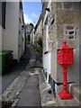
5
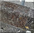
Ordnance Survey Rivet
This OS rivet can be found at the junction of Boase Street & Gwavas Road. It marks a point 31.353m above mean sea level.
Image: © Adrian Dust
Taken: 5 Jun 2024
0.03 miles
6
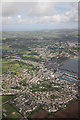
Newlyn
Aerial view of Newlyn from the Tresco - Penzance helicopter
Image: © Richard Croft
Taken: 2 Jul 2010
0.03 miles
8
Trewarveneth Street
Narrow seaside street leading away from the harbourside Fore Street.
Image: © Bob Embleton
Taken: 10 Aug 2008
0.03 miles
10
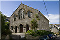
Centenary Methodist Church
The Centenary Methodist Church was built in 1927.
Image: © Elizabeth Scott
Taken: 24 Sep 2012
0.04 miles