IMAGES TAKEN NEAR TO
Newlyn, PENZANCE, TR18 5EA

Introduction

This page details the photographs taken nearby to TR18 5EA by members of the Geograph project.

The Geograph project started in 2005 with the aim of publishing, organising and preserving representative images for every square kilometre of Great Britain, Ireland and the Isle of Man.

There are currently over 7.5m images from over14,400 individuals and you can help contribute to the project by visiting https://www.geograph.org.uk

Image Map


Images are licensed for reuse under creativecommons.org/licenses/by-sa/2.0
Notes
  • Clicking on the map will re-center to the selected point.
  • The higher the marker number, the further away the image location is from the centre of the postcode.

Image Listing (154 Images Found)

Images are licensed for reuse under creativecommons.org/licenses/by-sa/2.0
  • ...
Image
Details
Distance
1
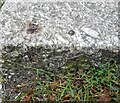
Ordnance Survey Rivet
This OS rivet can be found on the steps of No1 Parc Villas . It marks a point 42.619m above mean sea level.
Image: © Adrian Dust Taken: 5 Jun 2024
0.01 miles
2
Belle Vue
Off Bay View Terrace
Image: © Paul Barnett Taken: 5 May 2023
0.05 miles
3
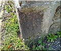
Ordnance Survey Cut Mark
This OS cut mark can be found on the wall of No1 Parc Terrace. It marks a point 52.164m above mean sea level.
Image: © Adrian Dust Taken: 5 Jun 2024
0.05 miles
4
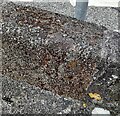
Ordnance Survey Rivet
This OS rivet can be found at the junction of Boase Street & Gwavas Road. It marks a point 31.353m above mean sea level.
Image: © Adrian Dust Taken: 5 Jun 2024
0.06 miles
5
Centenary Methodist Church
The Centenary Methodist Church was built in 1927.
Image: © Elizabeth Scott Taken: 24 Sep 2012
0.07 miles
6
Trewarveneth Street
Narrow seaside street leading away from the harbourside Fore Street.
Image: © Bob Embleton Taken: 10 Aug 2008
0.07 miles
7
Ordnance Survey Cut Mark
This OS cut mark can be found on The Coach House. It marks a point 42.878m above mean sea level.
Image: © Adrian Dust Taken: 5 Jun 2024
0.08 miles
8
Ordnance Survey Flush Bracket 1575
This bracket can be found on the wall of Newlyn School of Art. The benchmark height is recorded as being 68.531 metres above sea level. For more detail see : http://www.bench-marks.org.uk/bm1224
Image: © Peter Wood Taken: 1 May 2017
0.08 miles
9
Ordnance Survey Flush Bracket (1574)
This OS Flush Bracket can be found on the school. It marks a point 68.531m above mean sea level.
Image: © Adrian Dust Taken: 5 Jun 2024
0.08 miles
10
Penzance : Newlyn - Buildings
Buildings on the hillside seen from The Strand.
Image: © Lewis Clarke Taken: 28 Sep 2022
0.09 miles
  • ...