
IMAGES TAKEN NEAR TO
Voundervour Lane, PENZANCE, TR18 4UH
Introduction
This page details the photographs taken nearby to Voundervour Lane, TR18 4UH by members of the Geograph project.
The Geograph project started in 2005 with the aim of publishing, organising and preserving representative images for every square kilometre of Great Britain, Ireland and the Isle of Man.

There are currently over 7.5m images from over14,400 individuals and you can help contribute to the project by visiting https://www.geograph.org.uk
Image Map
Images are licensed for reuse under creativecommons.org/licenses/by-sa/2.0
Notes
- Clicking on the map will re-center to the selected point.
- The higher the marker number, the further away the image location is from the centre of the postcode.
Image Listing (721 Images Found)
Images are licensed for reuse under creativecommons.org/licenses/by-sa/2.0
Image
Details
Distance
1

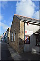
Salvation Arm Citadel, Penzance
On Queen Street. Erected in 1912.
Image: © Andrew Abbott
Taken: 4 Oct 2020
0.01 miles

4
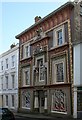
The Egyptian House, Chapel Street, Penzance
This extraordinary terraced house had its egyptian facade created in the 1830's, a time when interest in egyptology was high. It has been restored to its original colours.
Image: © Tony Atkin
Taken: 5 Mar 2006
0.02 miles
5
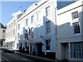
Union Hotel
A view looking northeast across Chapel Street to the Union Hotel, where the death of Admiral Nelson was first announced in 1805. To the rear of the building is the Georgian Theatre, built around 1786 and possibly one of the oldest remaining Georgian theatres in the country.
Image: © Phil Williams
Taken: 1 May 2006
0.02 miles
7
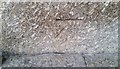
Ordnance Survey Cut Mark
This OS cut mark can be found on the front of the Methodist Chapel. It marks a point 20.664m above mean sea level.
Image: © Adrian Dust
Taken: 21 Feb 2017
0.03 miles
8

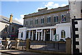
Wesleyan Methodist Church, Chapel Street, Penzance
Grade II* listed. Listing number 1143151. Erected in 1814. New portico and frontage erected in 1864. Granite ashlar. 2 storey front, 7 windows with semi-circular heads. Parapet raised at centre, cornice. Quoins. Ground floor, wide semi-circular entrances with fanlights and panelled double doors, Tuscan colonnade with entablature, with projecting rusticated porches at ends with flat pilaster quoins and semi-circular headed windows. Including iron railings to forecourt with lamp standards.
Image: © Andrew Abbott
Taken: 4 Oct 2020
0.03 miles
9
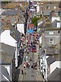
Chapel Street Penzance
Viewed from the top of St Mary's Church tower.
Image: © Rod Allday
Taken: 27 Jun 2015
0.03 miles
10
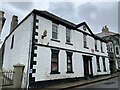
Former British Legion, Chapel Street, Penzance
Grade II listed. Listing number 1143150. C18 painted brickwork. Granite quoins. Modillioned eaves cornice. One string course. 2 storeys. 5 windows. Slight projection for central door and window pedimented. Doorway 2 Ionic pilasters and entablature. Extension to right, 2 storeys, granite ashlar, ground floor rusticated with double gates with fielded panels. Rusticated granite flat arch over. Segmental bowed sashes oriel above, modillioned eaves cornice., Slate hipped roof.
Image: © Andrew Abbott
Taken: 4 Oct 2020
0.03 miles