
IMAGES TAKEN NEAR TO
Mount Pleasant, PENZANCE, TR18 4QU
Introduction
This page details the photographs taken nearby to Mount Pleasant, TR18 4QU by members of the Geograph project.
The Geograph project started in 2005 with the aim of publishing, organising and preserving representative images for every square kilometre of Great Britain, Ireland and the Isle of Man.

There are currently over 7.5m images from over14,400 individuals and you can help contribute to the project by visiting https://www.geograph.org.uk
Image Map
Images are licensed for reuse under creativecommons.org/licenses/by-sa/2.0
Notes
- Clicking on the map will re-center to the selected point.
- The higher the marker number, the further away the image location is from the centre of the postcode.
Image Listing (19 Images Found)
Images are licensed for reuse under creativecommons.org/licenses/by-sa/2.0
Image
Details
Distance
1
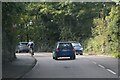
Penzance : Road
A road heading out from Penzance.
Image: © Lewis Clarke
Taken: 28 Sep 2022
0.06 miles
4
Penzance : Alverton Road
Looking along Alverton Road from the roundabout.
Image: © Lewis Clarke
Taken: 28 Sep 2022
0.12 miles
6
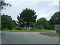
Roundabout on the A30
Looking north east on the outskirts of Penzance.
Image: © JThomas
Taken: 13 Jul 2017
0.14 miles
7

Bluebell Dell above Newlyn
This place is about my childhood. The bluebells manage somehow to keep the ivy in check. Good blackberries around here in late summer.
Image: © Martin Blowers
Taken: 3 May 2014
0.15 miles
9
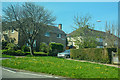
Penzance : Lansdowne Road
From Alverton Road looking towards houses on Lansdowne Road.
Image: © Lewis Clarke
Taken: 21 Apr 2018
0.19 miles
10
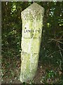
Old Milestone by the A30 on Penzance by-pass
Carved stone post by the A30, in parish of PENZANCE (PENWITH District), Trereife, Penzance by-pass, on the verge, on North side of road. Erected by the Local Highways Board in the 19th century.
Inscription reads:-
: PENZANCE / 1 : : LANDS END / 9 :
(Original plates missing)
Cornwall & Scilly HER.
HER Number: MCO54708 https://www.heritagegateway.org.uk/Gateway/Results_Single.aspx?uid=MCO54708&resourceID=1020
Milestone Society National ID: CW_LEPZ09.
Image: © Rosy Hanns
Taken: 5 Jul 2019
0.20 miles