IMAGES TAKEN NEAR TO
Posses Lane, PENZANCE, TR18 3FJ

Introduction

This page details the photographs taken nearby to Posses Lane, TR18 3FJ by members of the Geograph project.

The Geograph project started in 2005 with the aim of publishing, organising and preserving representative images for every square kilometre of Great Britain, Ireland and the Isle of Man.

There are currently over 7.5m images from over14,400 individuals and you can help contribute to the project by visiting https://www.geograph.org.uk

Image Map


Images are licensed for reuse under creativecommons.org/licenses/by-sa/2.0
Notes
  • Clicking on the map will re-center to the selected point.
  • The higher the marker number, the further away the image location is from the centre of the postcode.

Image Listing (41 Images Found)

Images are licensed for reuse under creativecommons.org/licenses/by-sa/2.0
  • ...
Image
Details
Distance
1
A wildflower roundabout
I hope it is intentional, rather just a cutback on Council services, but this roundabout is wonderfully full of wildflowers and a few well-protected trees.
Image: © David Medcalf Taken: 10 Jun 2021
0.02 miles
2
Byway Open to All Traffic?
Apparently not, but it is shown as a BOAT on the OS map. Yet another anomaly that should be easily resolved, but isn't.
Image: © David Medcalf Taken: 10 Jun 2021
0.04 miles
3
A colourful building wall
I think this is the back of the Sure Start centre. It shows a local scene and brightens up what would be a blank wall.
Image: © David Medcalf Taken: 10 Jun 2021
0.04 miles
4
Wall art
Colourful mural on the rear of a Cornwall Council building at Treneere.
Image: © Malcolm Kewn Taken: 13 May 2010
0.08 miles
5
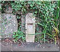
GPO marker
Left over from the days when the GPO operated the telephone system, these apparently mark the presence of inspection chambers.
Image: © Malcolm Kewn Taken: 21 Aug 2008
0.08 miles
6
Local shops in the suburbs
Image: © David Medcalf Taken: 10 Jun 2021
0.09 miles
7
Houses in the suburbs
Image: © David Medcalf Taken: 10 Jun 2021
0.10 miles
8
Lower Peverell Road
Seen in hazy evening light.
Image: © Malcolm Kewn Taken: 24 Jul 2012
0.13 miles
9
Up the steps to the playground
Image: © David Medcalf Taken: 10 Jun 2021
0.13 miles
10
Polmeere Road
Late autumn colours along the grass bank which separates the Penzance Distributor Road (off to the left) from housing at Treneere.
Image: © Malcolm Kewn Taken: 11 Nov 2012
0.14 miles
  • ...