
IMAGES TAKEN NEAR TO
Chyandaunce, PENZANCE, TR18 3BZ
Introduction
This page details the photographs taken nearby to Chyandaunce, TR18 3BZ by members of the Geograph project.
The Geograph project started in 2005 with the aim of publishing, organising and preserving representative images for every square kilometre of Great Britain, Ireland and the Isle of Man.

There are currently over 7.5m images from over14,400 individuals and you can help contribute to the project by visiting https://www.geograph.org.uk
Image Map
Images are licensed for reuse under creativecommons.org/licenses/by-sa/2.0
Notes
- Clicking on the map will re-center to the selected point.
- The higher the marker number, the further away the image location is from the centre of the postcode.
Image Listing (18 Images Found)
Images are licensed for reuse under creativecommons.org/licenses/by-sa/2.0
Image
Details
Distance
1

Direction sign - Signpost beside the B3311 at Gulval Alms Houses
Located on the front wall of Gulval Alms Houses, on the northeast side of the junction of the B3311 and School Lane. Penzance parish. 3 arms and cone finial. See also https://www.flickr.com/photos/38116967@N04/8108936371.
Milestone Society National ID: CW_SW4731B
Image: © P Barnett
Taken: 19 Apr 2026
0.03 miles
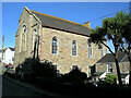
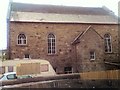
4
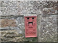
Ordnance Survey Flush Bracket G1998
This bracket can be found on the former Methodist Chapel at Gulval. The benchmark height is recorded as being 13.803 metres above sea level.
For more detail see : http://www.bench-marks.org.uk/bm10774
Image: © Peter Wood
Taken: 1 May 2017
0.07 miles
5
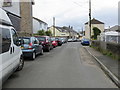
Trevarrack Road at Trevarrack
Looking south-eastward.
Image: © Peter Wood
Taken: 1 May 2017
0.09 miles
6
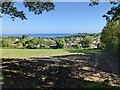
A field above Gulval
With a view of Mount's Bay.
Image: © David Medcalf
Taken: 13 Jun 2021
0.13 miles
7
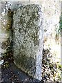
Old Guide Stone by the B3311 in Trythogga
Guide Stone by the B3311, in parish of Gulval (Penwith District), Green Lane Hill, T-junction with Polmennor Road, opposite Gulval village sign, against roadside wall.
Cornwall & Scilly HER.
HER Number: MCO64193 https://www.heritagegateway.org.uk/Gateway/Results_Single.aspx?uid=MCO64193&resourceID=1020
Surveyed
Milestone Society National ID: CW_XGUL
Image: © Rosy Hanns
Taken: 4 Jul 2019
0.15 miles
8

Old Guide Stone by the B3311, Trythogga, Gulval parish
Stone post by the B3311, in parish of Gulval (Penwith District), Green Lane Hill, T-junction with Polmennor Road, opposite Gulval village sign, against roadside wall.
Surveyed
Milestone Society National ID: CW_XGUL
Image: © Milestone Society
Taken: Unknown
0.15 miles
9
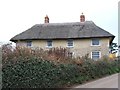
Thatched cottage
Trenow Farmhouse on the road to St Ives, just outside Penzance.
Image: © Malcolm Kewn
Taken: 25 Jan 2006
0.15 miles
10
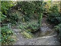
Bleu bridge
Modern handrailing on the bridge mars a rustic scene at Barlowena Bottom, near the village of Gulval. The Bleu Bridge inscribed stone is visible just left of centre.
Image: © Malcolm Kewn
Taken: 11 Nov 2012
0.16 miles