IMAGES TAKEN NEAR TO
Station Road, PENZANCE, TR18 2NF
Introduction
This page details the photographs taken nearby to Station Road, TR18 2NF by members of the Geograph project.
The Geograph project started in 2005 with the aim of publishing, organising and preserving representative images for every square kilometre of Great Britain, Ireland and the Isle of Man.

There are currently over 7.5m images from over14,400 individuals and you can help contribute to the project by visiting https://www.geograph.org.uk
Image Map
Images are licensed for reuse under creativecommons.org/licenses/by-sa/2.0
Notes
- Clicking on the map will re-center to the selected point.
- The higher the marker number, the further away the image location is from the centre of the postcode.
Image Listing (532 Images Found)
Images are licensed for reuse under creativecommons.org/licenses/by-sa/2.0
Image
Details
Distance
4
Arrival at Penzance
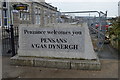
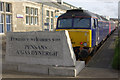
The 'Night Riviera' overnight sleeper train has just arrived into Penzance at 0800, having left Paddington at 2345 the previous evening. The stone block behind the buffer stops has a welcoming message in English and Cornish - but surely it is facing the wrong way?
Image: © Stephen McKay
Taken: 24 Mar 2009
0.00 miles
5
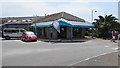
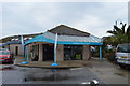
Information Centre, Penzance
Opposite Penzance railway station.
Image: © Jaggery
Taken: 4 Jun 2016
0.00 miles
7
Penzance railway station photo-survey (27)
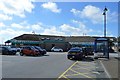
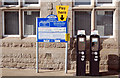
Carpark paypoint machines beside the entrance to Penzance railway station, terminus of the former Great Western Railway's West of England mainline from London and the westernmost station in England.
The original wooden station was opened by the West Cornwall Railway in 1852. The WCR was taken over by the GWR which constructed the current station which opened in 1879. Substantial improvements were made by the GWR in 1937. The station passed from the GWR to British Railways (Western Region) in 1948 when the railways were nationalised and is now operated by First Great Western. The current ticket office and buffet date from the 1980s.
The station stands beside the sea (partly on reclaimed land) and the main buildings are constructed of local stone. Platforms 1, 2 and 3 terminate inside a 'train shed' with an arched roof; however, platform 4 on the south side of the station is uncovered.
The extensive carpark and bus station southeast of the station were originally storage sidings and a large goods yard. One of the principal outbound traffics was fish from nearby Newlyn.
For earlier photos of Penzance with semaphore signals and locomotive-hauled trains see [http://www.geograph.org.uk/photo/1309200] , [http://www.geograph.org.uk/photo/814593] , [http://www.geograph.org.uk/photo/1309207] , [http://www.geograph.org.uk/photo/1215918] and [http://www.geograph.org.uk/photo/101797] .
Image: © Andy F
Taken: 17 Oct 2009
0.01 miles
8
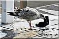
Glove gull
Not sure how this is supposed to fit, but it was a chilly day
Image: © Chris Morgan
Taken: 27 Sep 2020
0.01 miles
9
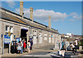
Penzance railway station photo-survey (1)
The main passenger entrance on the south side of Penzance railway station. The station is the terminus of the former Great Western Railway's West of England mainline from London and is the westernmost station in England.
The original wooden station was opened by the West Cornwall Railway in 1852. The WCR was taken over by the GWR which constructed the current station which opened in 1879. Substantial improvements were made by the GWR in 1937. The station passed from the GWR to British Railways (Western Region) in 1948 when the railways were nationalised and is now operated by First Great Western. The current ticket office and buffet date from the 1980s.
The station stands beside the sea (partly on reclaimed land) and the main buildings are constructed of local stone. Platforms 1, 2 and 3 terminate inside a 'train shed' with an arched roof; however, platform 4 on the south side of the station is uncovered.
The extensive carpark and bus station southeast of the station were originally storage sidings and a large goods yard. One of the principal outbound traffics was fish from nearby Newlyn.
For earlier photos of Penzance with semaphore signals and locomotive-hauled trains see [http://www.geograph.org.uk/photo/1309200] , [http://www.geograph.org.uk/photo/814593] , [http://www.geograph.org.uk/photo/1309207] , [http://www.geograph.org.uk/photo/1215918] and [http://www.geograph.org.uk/photo/101797] .
Image: © Andy F
Taken: 17 Oct 2009
0.01 miles