IMAGES TAKEN NEAR TO
Four Lanes, REDRUTH, TR16 6LJ
Introduction
This page details the photographs taken nearby to TR16 6LJ by members of the Geograph project.
The Geograph project started in 2005 with the aim of publishing, organising and preserving representative images for every square kilometre of Great Britain, Ireland and the Isle of Man.

There are currently over 7.5m images from over14,400 individuals and you can help contribute to the project by visiting https://www.geograph.org.uk
Image Map
Images are licensed for reuse under creativecommons.org/licenses/by-sa/2.0
Notes
- Clicking on the map will re-center to the selected point.
- The higher the marker number, the further away the image location is from the centre of the postcode.
Image Listing (31 Images Found)
Images are licensed for reuse under creativecommons.org/licenses/by-sa/2.0
Image
Details
Distance
2
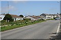
Four Lanes
Four Lanes is a mixture of 19th century terraced miners houses and more up-market 20th century housing shown in this photograph.
Image: © Tony Atkin
Taken: 27 Apr 2006
0.03 miles
3
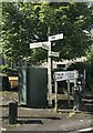
Direction Sign – Signpost on the B3297 at Four Lanes
Located on the south side of the crossroads on the B3297 at Four Lanes. Carn Brea parish. A resin replica of a fingerpost with 4 arms and a pyramid spear finial. See also https://www.geograph.org.uk/photo/6096232.
Milestone Society National ID: CW_SW6838
Image: © P Barnett
Taken: 14 Jun 2024
0.06 miles
4
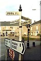
Old Direction Sign - Signpost by the B3297, Four Lanes
Pyramid spear finial - resin replica; Cornwall CC iron spear by the B3297, in parish of Carn Brea (Kerrier District), Four Lanes village square, on pavement.
Surveyed
Milestone Society National ID: CW_SW6938
Image: © Milestone Society
Taken: Unknown
0.06 miles
5
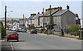
Four Lanes
Four Lanes is a village to the south of Redruth. Presumably it derives its name from the fact that it is on a crossroads, although not an important one now.
Image: © Tony Atkin
Taken: 27 Apr 2006
0.06 miles
6
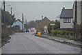
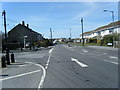
Four Lanes : Church Road B3297
Looking along the B3297 in Four Lanes.
Image: © Lewis Clarke
Taken: 18 Dec 2019
0.08 miles
7
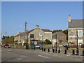
Bus shelter at the crossroads in Four Lanes
The building on the right (cut off in the picture) is the Victoria Inn, signed on the end wall of the house behind the bus shelter
Image: © David Smith
Taken: 14 Mar 2016
0.08 miles
8
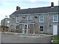
Victoria Inn, Four Lanes
Once owned by Punch Taverns, this village pub has been allowed to run down. Now in independent ownership, we are all looking forward to its reopening as a much needed village pub
Image: © Charles Weaver
Taken: 31 Aug 2010
0.09 miles