IMAGES TAKEN NEAR TO
Penmayne Parc, REDRUTH, TR16 5TN
Introduction
This page details the photographs taken nearby to Penmayne Parc, TR16 5TN by members of the Geograph project.
The Geograph project started in 2005 with the aim of publishing, organising and preserving representative images for every square kilometre of Great Britain, Ireland and the Isle of Man.

There are currently over 7.5m images from over14,400 individuals and you can help contribute to the project by visiting https://www.geograph.org.uk
Image Map
Images are licensed for reuse under creativecommons.org/licenses/by-sa/2.0
Notes
- Clicking on the map will re-center to the selected point.
- The higher the marker number, the further away the image location is from the centre of the postcode.
Image Listing (26 Images Found)
Images are licensed for reuse under creativecommons.org/licenses/by-sa/2.0
Image
Details
Distance
1
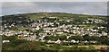
Lanner and Carn Marth
Taken from Chapel Hill to the south of the village of Lanner, this photo looks down on the village and up to Carn Marth above it.
Image: © Tony Atkin
Taken: 21 Aug 2007
0.08 miles
2
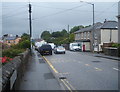
Bus stop on Lanner Hill, Lanner
Looking east.
Image: © JThomas
Taken: 11 Jul 2017
0.08 miles
3
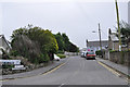
Lanner : Bell Lane
Looking along Bell Lane from Lanner Hill.
Image: © Lewis Clarke
Taken: 13 Jul 2015
0.09 miles
4
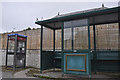
Lanner : Bus Stop
A bus stop and phone box on Lanner Hill.
Image: © Lewis Clarke
Taken: 13 Jul 2015
0.09 miles
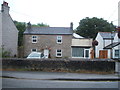
6
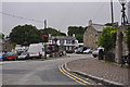
Lanner : Rough Street
Looking along Rough Street with the Lanner Inn in view.
Image: © Lewis Clarke
Taken: 13 Jul 2015
0.11 miles
8
Lanner : Lanner Hill A393
A fish and chip shop is seen here on Lanner Hill.
Image: © Lewis Clarke
Taken: 13 Jul 2015
0.11 miles