
IMAGES TAKEN NEAR TO
Sunnyvale Road, REDRUTH, TR16 4NE
Introduction
This page details the photographs taken nearby to Sunnyvale Road, TR16 4NE by members of the Geograph project.
The Geograph project started in 2005 with the aim of publishing, organising and preserving representative images for every square kilometre of Great Britain, Ireland and the Isle of Man.

There are currently over 7.5m images from over14,400 individuals and you can help contribute to the project by visiting https://www.geograph.org.uk
Image Map
Images are licensed for reuse under creativecommons.org/licenses/by-sa/2.0
Notes
- Clicking on the map will re-center to the selected point.
- The higher the marker number, the further away the image location is from the centre of the postcode.
Image Listing (73 Images Found)
Images are licensed for reuse under creativecommons.org/licenses/by-sa/2.0
Image
Details
Distance
1
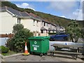
Modern housing
Modern housing in the outskirts of this very old village is very distinctive. This is Sunnyhill Road, which was formerly the tramway from Scorrier and Poldice.
Image: © Jonathan Wilkins
Taken: 9 Sep 2019
0.07 miles
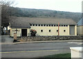
3
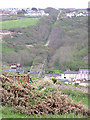
Portreath, the old railway incline
This incline (double track) was used to link the branch line from Redruth to the harbour to export minerals. It closed in the mid 1930s.
Image: © Martin Southwood
Taken: 6 May 2005
0.07 miles
4
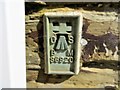
Ordnance Survey Flush Bracket S6920
This bracket can be found on the wall of Portreath Pre-School in Penberthy Road. The benchmark height is recorded as being 6.605 metres above sea level.
For more detail see : http://www.bench-marks.org.uk/bm11684
Image: © Peter Wood
Taken: 2 May 2017
0.07 miles
5
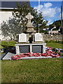
Portreath War Memorial
War Memorial in the front garden of the town church.
Image: © Richard Law
Taken: 18 Sep 2012
0.07 miles
6
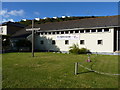
St Mary church, Portreath
The C of E church is situated on the north side of Penberthy Road, the main route into the village.
Image: © Richard Law
Taken: 18 Sep 2012
0.07 miles
7
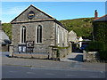
Portreath Millennium Hall
Clearly a former church (Methodist?), this is now a charity-funded community hall, providing theatre and other events.
Image: © Richard Law
Taken: 19 Sep 2012
0.07 miles
8
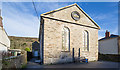
Portreath Millennium Hall
A former Methodist church, now a community hall.
Image: © David P Howard
Taken: 13 Jan 2016
0.08 miles
9
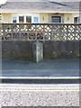
Portreath milestone
One of a series of stones between Portreath and Redruth, which is apparently 4 miles away.
Image: © Richard Law
Taken: 19 Sep 2012
0.09 miles
10
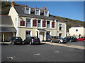
Portreath Arms
The Portreath Arms Hotel in the centre of Portreath.
Image: © Philip Halling
Taken: 25 Apr 2010
0.09 miles