IMAGES TAKEN NEAR TO
Penberthy Road, REDRUTH, TR16 4LW
Introduction
This page details the photographs taken nearby to Penberthy Road, TR16 4LW by members of the Geograph project.
The Geograph project started in 2005 with the aim of publishing, organising and preserving representative images for every square kilometre of Great Britain, Ireland and the Isle of Man.

There are currently over 7.5m images from over14,400 individuals and you can help contribute to the project by visiting https://www.geograph.org.uk
Image Map
Images are licensed for reuse under creativecommons.org/licenses/by-sa/2.0
Notes
- Clicking on the map will re-center to the selected point.
- The higher the marker number, the further away the image location is from the centre of the postcode.
Image Listing (24 Images Found)
Images are licensed for reuse under creativecommons.org/licenses/by-sa/2.0
Image
Details
Distance
1
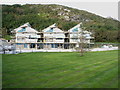
New build houses on Sunnyvale Road, Portreath
Image: © Richard Law
Taken: 21 Sep 2012
0.01 miles
3
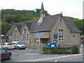
Portreath school
The community primary school in the village, originally opened in 1880.
Image: © Richard Law
Taken: 21 Sep 2012
0.05 miles
4
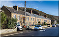
Cottages on Basset Terrace
A row of cottages on the B3300 heading east out of Portreath.
Image: © David P Howard
Taken: 13 Jan 2016
0.06 miles
6
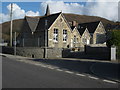
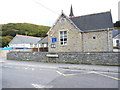
Portreath CP School
Portreath Community Primary School. The school's website informs that 'It was built over 125 years ago opening on 5th January 1880'.
Image: © Philip Halling
Taken: 25 Apr 2010
0.06 miles
7
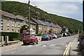
Terraced Houses, Portreath
These houses are strung out along the valley bottom road below a very steep hillside.
Image: © Tony Atkin
Taken: 15 Jun 2006
0.07 miles
8

The Mineral Tramway heading towards Portreath
The tramroad originally connected the tin and copper mines in the hills around Redruth and Camborne with the sea at Portreath, which has a good harbour for export. It's now converted to a footpath and cycleway, part of an extensive network of old mine roads in the district.
The sign on the door of the building implies that it contains some kind of electrical supply equipment.
Image: © Richard Law
Taken: 18 Sep 2012
0.10 miles
9
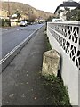
Old Milestone by the B3300, Penberthy Road, Portreath
Carved stone post by the B3300, in parish of PORTREATH (KERRIER District), Penberthy Road, opposite chapel, by the road, on South side of road. Erected by the Local Highways Board in the 19th century.
Inscription reads:-
: POOL / 3 : : REDRUTH / 4 :
Grade II listed.
List Entry Number: 1161478
Milestone Society National ID: CW_PORR03.
Image: © Paul Barnett
Taken: 23 Dec 2022
0.12 miles