
IMAGES TAKEN NEAR TO
Parc Erissey, REDRUTH, TR16 4HW
Introduction
This page details the photographs taken nearby to TR16 4HW by members of the Geograph project.
The Geograph project started in 2005 with the aim of publishing, organising and preserving representative images for every square kilometre of Great Britain, Ireland and the Isle of Man.

There are currently over 7.5m images from over14,400 individuals and you can help contribute to the project by visiting https://www.geograph.org.uk
Image Map
Images are licensed for reuse under creativecommons.org/licenses/by-sa/2.0
Notes
- Clicking on the map will re-center to the selected point.
- The higher the marker number, the further away the image location is from the centre of the postcode.
Image Listing (9 Images Found)
Images are licensed for reuse under creativecommons.org/licenses/by-sa/2.0
Image
Details
Distance
1
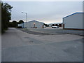
Parc Erissey Industrial Estate
Rather gloomy evening light on a couple of light industrial units on the estate.
Image: © Richard Law
Taken: 16 Sep 2012
0.13 miles
2
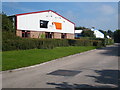
Industrial units at Parc Erissey
A small industrial estate on the outskirts of Redruth.
Image: © Rod Allday
Taken: 3 Sep 2010
0.16 miles
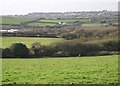
4
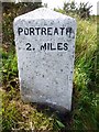
Old Milestone by the B3300, north of Tolgus Mill
Carved stone post by the B3300, in parish of REDRUTH (KERRIER District), High Laity Farm, New Portreath Road, very neat and undamaged, on West side of road. Erected by the Local Highways Board in the 19th century.
Inscription reads:-
: PORTREATH / 2. MILES : : REDRUTH / 2. MILES :
Grade II listed.
List Entry Number: 1309865 https://historicengland.org.uk/listing/the-list/list-entry/1309865
Milestone Society National ID: CW_PRRR02.
Image: © Rosy Hanns
Taken: 1 Jun 2019
0.22 miles
5
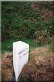
Old Milestone by the B3300, north of Tolgus Mill
Carved stone post by the B3300, in parish of REDRUTH (KERRIER District), High Laity Farm, New Portreath Road, 'V' neat and undamaged, on West side of road. Erected by the Local Highways Board in the 19th century.
Inscription reads:-
: PORTREATH / 2.MILES : : REDRUTH / 2.MILES :
Grade II Listed. List Entry Number: 1309865
https://historicengland.org.uk/listing/the-list/list-entry/1309865
Milestone Society National ID: CW_PRRR02.
Image: © Ian Thompson
Taken: 10 Dec 2017
0.22 miles
6
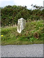
The Parc Erissey milestone - detail
Halfway between Redruth and Portreath; 2 miles to each of them.
Image: © Richard Law
Taken: 16 Sep 2012
0.23 miles
7

Access road for Parc Erissey
Access for a BMX track and small industrial estate
Image: © David Smith
Taken: 11 Mar 2016
0.23 miles
8

Advert for BMX track, New Portreath Road
Image: © David Smith
Taken: 11 Mar 2016
0.24 miles
9
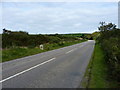
The Parc Erissey milestone beside the B3300
One of a number of milestones along the B3300
Image: © Richard Law
Taken: 16 Sep 2012
0.24 miles