
IMAGES TAKEN NEAR TO
Bridge Hill, REDRUTH, TR16 4FN
Introduction
This page details the photographs taken nearby to Bridge Hill, TR16 4FN by members of the Geograph project.
The Geograph project started in 2005 with the aim of publishing, organising and preserving representative images for every square kilometre of Great Britain, Ireland and the Isle of Man.

There are currently over 7.5m images from over14,400 individuals and you can help contribute to the project by visiting https://www.geograph.org.uk
Image Map
Images are licensed for reuse under creativecommons.org/licenses/by-sa/2.0
Notes
- Clicking on the map will re-center to the selected point.
- The higher the marker number, the further away the image location is from the centre of the postcode.
Image Listing (24 Images Found)
Images are licensed for reuse under creativecommons.org/licenses/by-sa/2.0
Image
Details
Distance
1
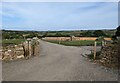
A new lane at Rayle Farm
I think it has been created to serve a new campsite. Neither the lane of the campsite are shown on the OS map.
Image: © David Medcalf
Taken: 29 Aug 2022
0.07 miles
2
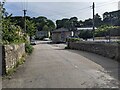
The pub in Bridge
Called, naturally enough, The Bridge Inn.
Image: © David Medcalf
Taken: 29 Aug 2022
0.12 miles
3

Looking down Bridge Hill
Bridge, a small hamlet near to Portreath
Image: © Pete Cruse
Taken: 12 Mar 2025
0.12 miles
4
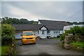
Portreath : Bungalow
A house off Penberthy Road.
Image: © Lewis Clarke
Taken: 2 Oct 2022
0.13 miles
5
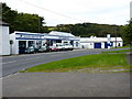
Bridge Garage
A small repair shop and second-hand vehicle business.
Image: © Richard Law
Taken: 16 Sep 2012
0.13 miles
7
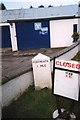
Old Milestone by the B3300, New Portreath Road, Portreath Parish
Carved stone post by the B3300, in parish of PORTREATH (KERRIER District), Bridge; New Portreath Road, by Mitchell's Garage forecourt, by the road, on South side of road. Erected by the Local Highways Board in the 19th century.
Inscription reads:-
: PORTREATH / 1.MILE : : REDRUTH / 3. MILES :
Grade II Listed. List Entry Number: 1409062
https://historicengland.org.uk/listing/the-list/list-entry/1409062
Milestone Society National ID: CW_PRRR01.
Image: © Ian Thompson
Taken: Unknown
0.14 miles
8
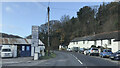
Old Milestone by the B3300, New Portreath Road, Bridge
Carved stone post by the B3300, in parish of PORTREATH (KERRIER District), Bridge, New Portreath Road, by Mitchell's Garage forecourt, by the road, on South side of road. Erected by the Local Highways Board in the 19th century.
Inscription reads:-
: PORTREATH / 1. MILE : : REDRUTH / 3. MILES :
Grade II listed.
List Entry Number: 1409062
Milestone Society National ID: CW_PRRR01.
Image: © Paul Barnett
Taken: 31 Dec 2022
0.14 miles
9
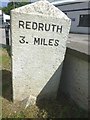
Old Milestone by the B3300, New Portreath Road, Bridge
Carved stone post by the B3300, in parish of PORTREATH (KERRIER District), Bridge, New Portreath Road, by Mitchell's Garage forecourt, by the road, on South side of road. Erected by the Local Highways Board in the 19th century.
Inscription reads:-
: PORTREATH / 1. MILE : : REDRUTH / 3. MILES :
Grade II listed.
List Entry Number: 1409062 https://historicengland.org.uk/listing/the-list/list-entry/1409062
Milestone Society National ID: CW_PRRR01.
Image: © Rosy Hanns
Taken: 1 Jun 2019
0.14 miles
10
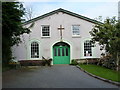
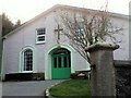
Bridge Methodist Church
The sign in the window says, rather disconcertingly, "Beware of the bees", as there is/was a very active colony of honey bees working out of one of the airbricks in the gable end. No news on what they make of the services in the church.
Image: © Richard Law
Taken: 16 Sep 2012
0.14 miles