IMAGES TAKEN NEAR TO
Tarewaste, REDRUTH, TR15 3SJ
Introduction
This page details the photographs taken nearby to TR15 3SJ by members of the Geograph project.
The Geograph project started in 2005 with the aim of publishing, organising and preserving representative images for every square kilometre of Great Britain, Ireland and the Isle of Man.

There are currently over 7.5m images from over14,400 individuals and you can help contribute to the project by visiting https://www.geograph.org.uk
Image Map
Images are licensed for reuse under creativecommons.org/licenses/by-sa/2.0
Notes
- Clicking on the map will re-center to the selected point.
- The higher the marker number, the further away the image location is from the centre of the postcode.
Image Listing (12 Images Found)
Images are licensed for reuse under creativecommons.org/licenses/by-sa/2.0
Image
Details
Distance
1
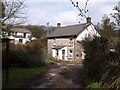
Cottages, Tarewaste
Seen from the end of the lane shown in Image The footpath indicated seems to get a double title: 224/19/2 and 224/19/1.
Image: © Derek Harper
Taken: 23 Feb 2009
0.00 miles
2
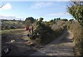
Lane to Tolskithy
In fact the lane is a dead end, but is continued by footpaths. On the left across the field is the valley shown in Image
Image: © Derek Harper
Taken: 23 Feb 2009
0.06 miles
3
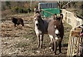
Donkeys near Great South Tolgus Mine
By Image On the left, an extremely hirsute miniature pony.
Image: © Derek Harper
Taken: 23 Feb 2009
0.10 miles
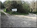
5

A small wind turbine near Tolgus Mount
In the distance is the outline of Carn Brea, with its castle and the Basset monument.
Image: © Rod Allday
Taken: 3 Sep 2010
0.21 miles