
IMAGES TAKEN NEAR TO
West Trewirgie Road, REDRUTH, TR15 2TJ
Introduction
This page details the photographs taken nearby to West Trewirgie Road, TR15 2TJ by members of the Geograph project.
The Geograph project started in 2005 with the aim of publishing, organising and preserving representative images for every square kilometre of Great Britain, Ireland and the Isle of Man.

There are currently over 7.5m images from over14,400 individuals and you can help contribute to the project by visiting https://www.geograph.org.uk
Image Map
Images are licensed for reuse under creativecommons.org/licenses/by-sa/2.0
Notes
- Clicking on the map will re-center to the selected point.
- The higher the marker number, the further away the image location is from the centre of the postcode.
Image Listing (41 Images Found)
Images are licensed for reuse under creativecommons.org/licenses/by-sa/2.0
Image
Details
Distance
2
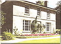
Trewirgie House
Trewirgie House is a bed and breakfast establishment not far from the centre of Redruth
Image: © Rob K Brettle
Taken: 24 Aug 1997
0.11 miles
5
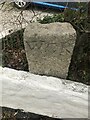
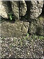
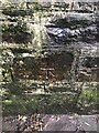
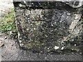
Old Boundary marker near railway bridge
The boundary stone is on the East side of the road in a flowerbed outside number 7 Coach Road. Redruth parish (Kerrier district). It marks the boundary of the West Cornwall Railway.
Inscription reads:-
WCR
Milestone Society National ID: CW_REDRU08em
HER https://www.heritagegateway.org.uk/Gateway/Results_Single.aspx?uid=MCO61863&resourceID=1020
Image: © Paul Barnett
Taken: 21 Feb 2023
0.16 miles

9
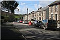
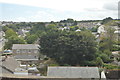
Trevingey Road
In the background is the northeastern slope of Carn Brea.
Image: © Tony Atkin
Taken: 3 Mar 2007
0.20 miles
10
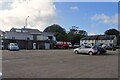
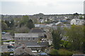
Redruth 1st railway station (site), Cornwall
Opened in 1843 by The Hayle Railway, later part of the West Cornwall Railway, as the terminus of its line from Hayle, this station closed to passengers in 1852 when services were transferred to the current Redruth station. The site continued as a good station into the 20th Century.
View southwest from somewhere near the buffers. The station site was the buildings to the left of the red lorry - the wall is a later construction.
Image: © Nigel Thompson
Taken: 26 Oct 2024
0.20 miles