
IMAGES TAKEN NEAR TO
College Street, CAMBORNE, TR14 7JX
Introduction
This page details the photographs taken nearby to College Street, TR14 7JX by members of the Geograph project.
The Geograph project started in 2005 with the aim of publishing, organising and preserving representative images for every square kilometre of Great Britain, Ireland and the Isle of Man.

There are currently over 7.5m images from over14,400 individuals and you can help contribute to the project by visiting https://www.geograph.org.uk
Image Map
Images are licensed for reuse under creativecommons.org/licenses/by-sa/2.0
Notes
- Clicking on the map will re-center to the selected point.
- The higher the marker number, the further away the image location is from the centre of the postcode.
Image Listing (24 Images Found)
Images are licensed for reuse under creativecommons.org/licenses/by-sa/2.0
Image
Details
Distance
5
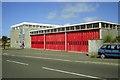
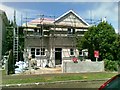
Camborne Fire Station
Camborne Fire Station, College Street, Camborne, Cornwall.
Image: © Kevin Hale
Taken: 24 Sep 1995
0.13 miles
7
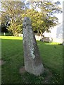
Old Wayside Cross
Connor Downs Cross, a wayside cross - moved, with old head & shaft. Set on the west side of the tower in the churchyard. Camborne parish. Langdon WC No. 12. Grade II Listed https://historicengland.org.uk/listing/the-list/list-entry/1328138. See also http://www.flickr.com/photos/ocifant/2837310246.
Milestone Society National ID: CWKE_CAM02
Image: © L Nott
Taken: 19 Sep 2019
0.19 miles
9

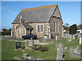
Two ancient crosses in the grounds of Camborne Parish Church
Image: © Rod Allday
Taken: 22 Oct 2008
0.19 miles
10
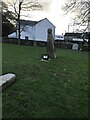
Ancient cross in St Martin churchyard
It has been suggested that this wayside cross was originally a boundary stone
between the parishes of Gwinear and Gwithian. In 1613 it was called the 'Meane
Cadoarth' or battle stone. Its name may commemorate a battle at Reskajeage,
5km to the north west. The panel of dots or shallow holes on the shaft is
traditionally believed to represent each person killed in the battle.
In 1896 when the historian Langdon visited the cross, it was in use as a
gatepost on Connor Downs, 4.5km south west of Camborne church. It was
considered that the cross probably marked the road between Hayle and Camborne,
on an important early route through Cornwall, close to the modern A30 trunk
road. The route from Camborne to Hayle is crossed at Connor Downs by minor
routes to Gwithian and the north coast, and routes south towards the important
market town of Helston. In 1904 the cross was moved into Camborne churchyard
and erected in its present location.
Milestone Society National ID: CWKE_CAM02
Image: © Paul Barnett
Taken: 18 Jan 2023
0.19 miles